Blog Posts Tagged ‘outdoors’

New Year – Get Outside

New Year’s Resolution – Get Outside!
This is the time of year that we relish after those long, hot, tortuous days of summer. Why not make a New Year’s resolution to get outdoors and enjoy your city or town?

resizedImg_Marana Mountains

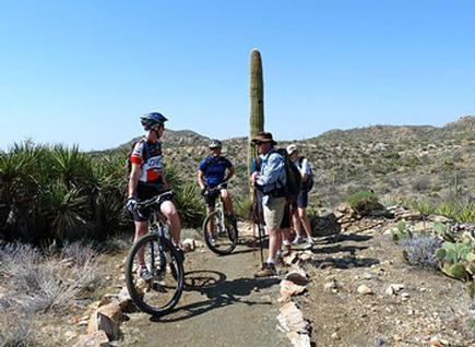
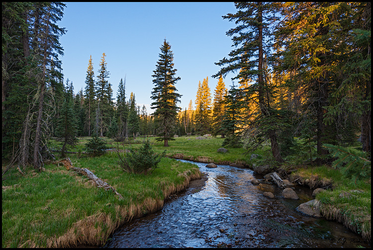
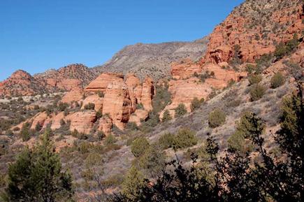
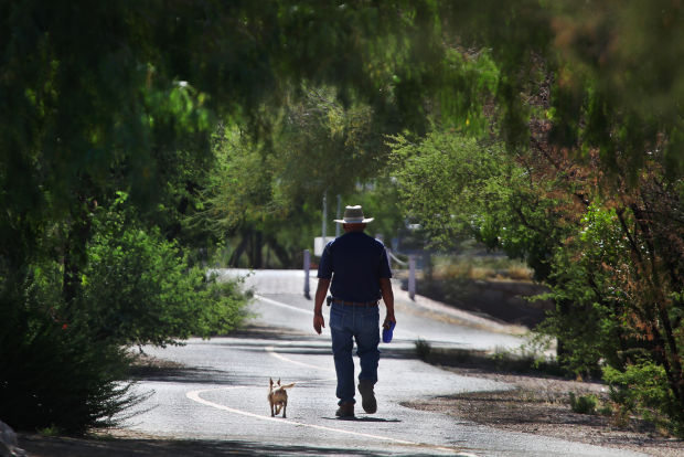
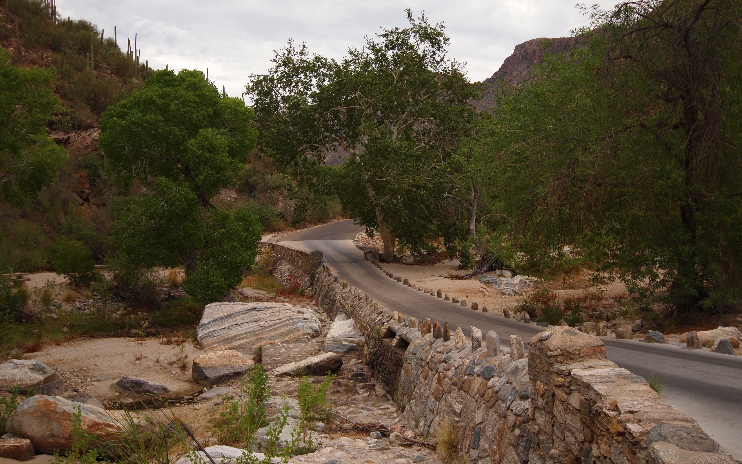
If you’ve got sunshine in southern Arizona, a hike up a mountain trail is the perfect way to spend your winter afternoon. The Town of Marana has numerous outdoor recreation opportunities, including more than 30 miles of trails in the Tortolia Mountains. The Town offers free Saturday morning guided hikes for individuals to get exercise, have fun and meet fellow hikers. Put it on your list to breathe in the fresh air and join them for one of these events!

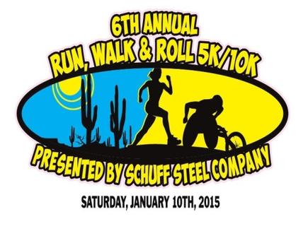
City of Mesa has a way to get outdoors and support a great cause! Their sixth annual Run, Walk & Roll 5K/10K is being held on Saturday, Jan. 10 at Mesa Riverview Park. Participants of all ages and ability levels are encouraged to sign up. The race will bring together the entire community to support sports and recreational opportunities for individuals with disabilities. For more info or to register, visit www.RunWalkRollAz.com. Be sure to check our Mesa Parks & Recreation for even more outdoor opportunities to start 2015 off right!

resizedImg_Blog Mesa RWR

If a relaxing afternoon in the park is more your speed, look no further than the City of Surprise’s 2nd Sunday in the Park. Enjoy an afternoon at the park with live musical entertainment on the second Sunday of each month. The free family event is fun for all ages. Upcoming shows will be held on Januray 11, February 8 and March 8. Click here to find events happening in Surprise all year long!

resizedImg_FlagSki

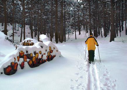
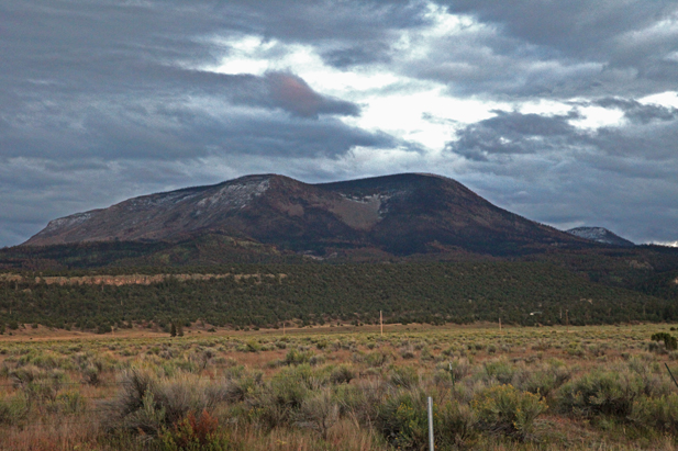
And don’t forget about SNOW! Northern Arizona and the White Mountains have plenty of opportunities to ski, snowboard and build snowmen. Check out the Great Arizona Road Trip for more ideas for cold weather adventures and year-round activities!


Escudilla Mountain

(Courtesy photo)

(Courtesy photo)

Escudilla Mountain is located in the White Mountains of Eastern Arizona near the town of Eagar. It is considered the third highest mountain in Arizona, and like the others, is volcanic in origin. Though there are eleven higher named summits in the state, most are considered subpeaks of either Humphrey’s Peak or Mount Baldy. The name Escudilla is Spanish for “a small bowl,” and the mountain may have been named by early Hispanic settlers in the region, or possibly by a member of Coronado’s 1540 Expedition through the Southwest. In 1984 the Escudilla Wilderness Area was created, encompassing 5,200 acres of Escudilla Mountain and the surrounding area of the Apache National Forest. Two primary trails are utilized for this moderate dayhike. The scenic Escudilla National Recreation Trail #308 is used by most hikers while the steeper Government Trail #119 receives less traffic since it is slightly longer with fewer views of the surrounding lowlands. They may be combined to form a loop. The fire lookout tower on Escudilla Mountain is the highest in Arizona although it is not on the true summit. A climb to the top of it offers spectacular views into New Mexico and the surrounding area. Mount Baldy can be seen to the west. The tower is occupied daily and permission should be acquired from the lookout before ascending the steps. Permission will not be granted if it is raining. For more information and park updates, visit: http://www.fs.usda.gov/recarea/asnf/recreation/recarea/?recid=45293&actid=50.

Apache-Sitgreaves National Forest

(Courtesy photo)

(Courtesy photo)

The Apache and the Sitgreaves National Forests were administratively combined in 1974 and are now managed as one unit from the Forest Supervisor’s Office in the town of Springerville. The 2 million-acre forest encompasses magnificent mountain country in east-central Arizona along the Mogollon Rim and the White Mountains.

What makes this forest so special? Its the water – and plenty of it – draining the high mountains and forming numerous lakes and streams, making it a fisherman’s paradise, or for anyone else who enjoys a lakeside view coupled with a beautiful, mountainous backdrop in the arid Southwest.

The Apache-Sitgreaves has 34 lakes and reservoirs and more than 680 miles of rivers and streams – more than can be found in any other Southwestern National Forest. The White Mountains contain the headwaters of several Arizona rivers including the Black, the Little Colorado, and the San Francisco.

The Sitgreaves was named for Captain Lorenzo Sitgreaves, a government topographical engineer who conducted the first scientific expedition across Arizona in the early 1850’s. On the Sitgreaves, the major attractions for visitors from the hot valleys of Phoenix or Tucson are the Mogollon Rim and the string of man-made lakes. From the Rim’s 7600-foot elevation, vista points provide inspiring views of the low country to the south and west.

In the last century, the U.S. Army established a series of forts in New Mexico and Arizona. To supply these forts and settlements, a military road was built linking Sante Fe, New Mexico and Camp Verde near Prescott. Part of this road, called the General Crook Trail, runs almost the length of the Sitgreaves and in many places follows the brink of the Rim.

The Apache National Forest is named after the tribes that settled in this area. It ranges in elevation from 3500 feet near Clifton to nearly 11,500 feet on Mount Baldy. The congressionally proclaimed Mount Baldy, Escudilla, and Bear Wallow wildernesses and the Blue Range Primitive Area make the Apache one of America’s premier backcountry Forests. The Apache is also noted for its trout streams and high-elevation lakes and meadows.

With the abundance of natural beauty one can take in on a hike or setting up camp, along with the rich history of this vast area, what’s not to love?

For more information and park updates, visit: http://www.fs.usda.gov/asnf.

Lyman Lake State Park

(Courtesy photo)

(Courtesy photo)


Created as an irrigation reservoir by damming the Little Colorado River, Lyman Lake State Park is located off the State Route 180 between towns of St. Johns and Springerville. The lake is a 1,200-acre park that encompasses the shoreline of a 1,500-acre reservoir at an elevation of 6,000 feet. It is fed by snowmelt from the slopes of Mount Baldy and Escudilla Mountain, the second and third highest mountains in Arizona. Water is channeled into this river valley from a 790-square-mile watershed extending into New Mexico.

Because of its size, Lyman Lake is one of the few bodies of water in Northeastern Arizona with no size restrictions on boats, however certain areas are buoyed off in order to create a peaceful (and successful) fishing area. The fishery consists of walleye, channel catfish and largemouth bass. The large remainder of the lake is open for all other types of water sports.

Lyman Lake really comes into its own during the spring, summer, and fall. Summer days, with temperature highs in the 80’s to low 90’s, are perfect for fishing, swimming, leisure boating, water-skiing, hiking or just plain relaxing.

For more information, visit: http://azstateparks.com/Parks/LYLA/.

Kearny Lake

(Courtesy photo)

(Courtesy photo)


Kearny Lake, while it has been fisherman’s best-kept secret as a prime place to catch bass and catfish, has also attracted those who want a peaceful, lakeside picnic, or enjoy some outdoors with some camping, is located off of State Route 177 just outside of the town of Kearny.

After a major portion of the existing park was swept away from a flood in 1983, town  and park officials decided they would create a lake, as well as set up places for picnics and camping (with 12 campsites available). Today, the area is managed by the Kearny Parks Department, and the lake is stocked from November to March with catchable-sized rainbow trout. Other species available include largemouth bass, catfish and, of course, sunfish. Boats are allowed on the lake, although motors are limited to electric trolling motors.

It may be a small and humble recreational area, but with the seclusion its a fisherman’s or outdoorsman’s dream.

Christopher Creek

christopher creek 2_prescott area_8.4.14

Image courtesy of rimcountry.com

With an elevation over a mile-high(5640 ft), Christopher Creek Campground’s crisp, fresh air and vibrant views are a joy to behold. The facility is tucked along the banks of the spring-fed Christopher Creek, which passes just below the Mogollon Rim.

The Mogollon Rim, pronounced by locals as “muggy-own,” is a 200-mile long cliff in northern Arizona that ranges between 5,000 and 7,000 ft in elevation. The unique landscape was created by extreme erosion and faulting that has sculpted spectacular canyons and buttes. The rim serves as the geographical dividing line between the cool high country above and the hot, dry desert below. Christopher Creek is located in the desert portion, but is balanced by the cool waters of the creek and forested surroundings.

After a day of horseback riding or mountain biking, take a dip in one of the facility’s three swimming holes to cool off from the summer sun. Or if winter is more your thing, visit during the snowy months to take advantage of the miles of cross-country skiing available. Each spring, the creek is stocked with rainbow trout, allowing anglers the opportunity to cast their hearts out for rainbows as well as brook and brown trout.

The small town of Christopher Creek is just a short drive away and offers a few restaurant options for those who tire of cooking at the campground. A series of lakes called the Rim Country Lakes are about a 10 minute drive east. Woods Canyon Lake is one of the most popular recreational lakes in the state and offers options for boating as well as a nature trail that loops around the lake’s perimeter.

Information courtesy of recreation.gov; learn more here.

Dogie Trail

Image courtesy of greatsedonahikes.com

Image courtesy of greatsedonahikes.com

The Dogie Trail is a step back into the days where Cowboys ruled the land. Dogie is cowboy slang for motherless calf, alluding to the area’s ranching history. Cowboys once herded cattle along this route through Sycamore Canyon. Evidence of this history remains in the form of stock tanks that sit along the path. The trail is covered with crimson-and-cream colored bluffs topped with junipers and pinon pines. Hikers may find pools that linger from recent rains shaded by cottonwood and willow trees. The hike ends at junction with the Sycamore Basin Trail in the Coconino National Forest. The trail is hailed as a rugged beauty that has been unspoiled and untamed by man.

Julian Wash Archaeological Park

julian wash archaelogical park_southern_7.28.14

This Archaeological park features a multi-use trail and interpretive signage about the Julian Wash archaeological site and St. Luke’s Orphanage, which also used to be at this location.

Visitors of this park will get to learn about Tucson’s 4,000-year history of continuous settlement and agriculture.

There are also bike routes within this park. Travelers have found a 40.42 mile bike ride within the area. This particular bike ride has a total ascent of 534.79 feet and has a maximum elevation of 2,814.76 feet.

Another route within the park showcases the natural beauty of the Sonoran Desert as it travels form Santa Cruz River Park to S. Rita Road in southeastern Tucson. The trail offers views of distant mountains and connects several other parks together.

Sabino Canyon

OLYMPUS DIGITAL CAMERA

Located near Tucson, Sabino Canyon tours offers a narrated, educational 45-minute, 3.8 mile tour into the foothills of the Santa Catalina Mountains. The trams have nine stops along the tour with several restroom facilities and picnic grounds located near Sabino Creek. The tram turns around at Stop #9 and heads back down to the Visitor’s Center, at which point riders may remain on board and hike back down. Trams arrive on average every 30 minutes.

A variety of trails are available along the way for hiking that range from easy to challenging. The main road, one of two routes on which Sabino Canyon Tours operates its Sabino Canyon tram route, is mostly flat and paved. It can be easily navigated by visitors of all ages. The main road ascends from 2,800 to 3,300 feet and crosses Sabino Creek over 9 stone bridges. It is a favorite route for both hikers and bicyclists.


To find out more information about the different trails offered, visit: http://www.sabinocanyon.com/.

Colossal Cave

colossal cave_southern_7.281.4

How about a hiking trail where you keep cool – as in hiking in 70 degrees and no sunlight? Colossal Cave tour route is a half-mile long and takes about 45-50 minutes to complete. As your guide relates the Cave’s history, legends, and geology, you walk down and back up about six and a half stories and see beautiful cave formations like stalactites, stalagmites, flowstone, boxwork, and helictites.

Tours are given daily, year-round. They are not pre-scheduled, but you’ll never wait longer than 30 minutes after you purchase your ticket. You need no special clothing in the Cave, which is always 70 degrees and dry. You are welcome to take pictures inside – you’ll want to use high-speed film and a flash unit for cameras, or a candlelight setting for videocams. Please click here for rates and Park hours.

To check availability and purchase tickets online for a Regular Tour go to Zerve or call (800) 979-3370