Blog Archive for Author : laurentwigg

Escudilla Mountain

(Courtesy photo)

(Courtesy photo)

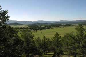
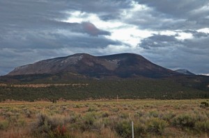
Escudilla Mountain is located in the White Mountains of Eastern Arizona near the town of Eagar. It is considered the third highest mountain in Arizona, and like the others, is volcanic in origin. Though there are eleven higher named summits in the state, most are considered subpeaks of either Humphrey’s Peak or Mount Baldy. The name Escudilla is Spanish for “a small bowl,” and the mountain may have been named by early Hispanic settlers in the region, or possibly by a member of Coronado’s 1540 Expedition through the Southwest. In 1984 the Escudilla Wilderness Area was created, encompassing 5,200 acres of Escudilla Mountain and the surrounding area of the Apache National Forest. Two primary trails are utilized for this moderate dayhike. The scenic Escudilla National Recreation Trail #308 is used by most hikers while the steeper Government Trail #119 receives less traffic since it is slightly longer with fewer views of the surrounding lowlands. They may be combined to form a loop. The fire lookout tower on Escudilla Mountain is the highest in Arizona although it is not on the true summit. A climb to the top of it offers spectacular views into New Mexico and the surrounding area. Mount Baldy can be seen to the west. The tower is occupied daily and permission should be acquired from the lookout before ascending the steps. Permission will not be granted if it is raining. For more information and park updates, visit: http://www.fs.usda.gov/recarea/asnf/recreation/recarea/?recid=45293&actid=50.
Stinson Pioneer Museum

(Courtesy photo)

(Courtesy photo)


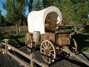
The Stinson Pioneer Museum, located in the town of Snowflake, houses artifacts and pictures from the early days of Snowflake, from prehistoric Indians to 19th century pioneers. Included on display is the loom used by Lucy Hannah Flake to weave cloth and rag rugs. Two rooms have been restored to depict the living conditions of the early pioneer families.

Additionally, the town has more than 100 historical buildings, most restored to their original condition, which can be seen in this walking tour. Spinning, weaving, blacksmithing, and quilting demonstrations are also available, as well as a horse drawn wagon for groups by appointment.

Come visit historic Snowflake and admire the dedication and hard work of the pioneers who built the foundation of what the beautiful and peaceful town is today.

Eastern Arizona Museum and Historical Society

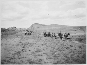
A section of railroad being built in Eastern Arizona, circa 1900. (Courtesy photo)

A section of railroad being built in Eastern Arizona, circa 1900. (Courtesy photo)


Enjoy reading up on some Eastern Arizona history by visiting the Eastern Arizona Museum and Historical Society located in the town of Pima. The building the museum is located in is, in itself a historical piece, as it used to be the Bank of Pima, the oldest structure in Pima. The building was constructed in 1882 of tufa stone from the limestone quarry at Bear Springs Flat and was originally used as a community conference area. Of the trio of historical buildings used for the museum is the Old Rexall Drug Store, built around 1900 and moved to the old Royal Confectionery building in 1928. When you step inside the museum, it’s as though everything inside the building had been frozen in time from the early 1900s, with original fixtures, tools, and various items that had long since been left behind by their owners.

Museum collections include:

American Indian Artifacts

Arizona History books

Barbed wire collections

Guns and knives

Hand tools

Handwork

Individual and family histories

Photographs

Quilts

School Annuals and Artifacts

Vintage clothing, shoes, jewelry and grooming items

Wood carvings – an extensive collection by local Don McFate

For museum operating hours and more information about the museum, please visit: http://easternarizonamuseum.com/.

Kearny Lake

(Courtesy photo)

(Courtesy photo)


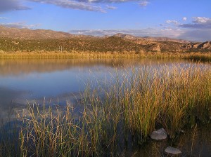
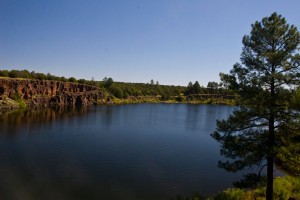
Kearny Lake, while it has been fisherman’s best-kept secret as a prime place to catch bass and catfish, has also attracted those who want a peaceful, lakeside picnic, or enjoy some outdoors with some camping, is located off of State Route 177 just outside of the town of Kearny.

After a major portion of the existing park was swept away from a flood in 1983, town  and park officials decided they would create a lake, as well as set up places for picnics and camping (with 12 campsites available). Today, the area is managed by the Kearny Parks Department, and the lake is stocked from November to March with catchable-sized rainbow trout. Other species available include largemouth bass, catfish and, of course, sunfish. Boats are allowed on the lake, although motors are limited to electric trolling motors.

It may be a small and humble recreational area, but with the seclusion its a fisherman’s or outdoorsman’s dream.

The Copper Corridor Scenic Road West

(Courtesy photo: Arizona Dept. of Transportation)

(Courtesy photo: Arizona Dept. of Transportation)


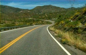
The Copper Corridor on State Route 177 spans 32 miles, taking you through the towns of Hayden and Winkelman. The scenic road runs parallel to the Gila River on the northeast side of its floodplain, alternately traversing lower slopes and ridges of Dripping Springs Mountains and steep, rock arroyos and canyons trending southwest toward the floodplain of the river.

Extensive surface mining activity is quite visible, especially at the Ray Mine, and is so vast that the mine itself has become the landscape. The undeveloped area of the Tonto National Forest, near Ray Mine provides a splendidly rugged wilderness visual, as do two other short sequences on either side of the Kearny community.

Visual experiences along the road is punctuated by significant landforms. Picketpost Mountain, located west of Superior, features a squared-off peak containing thick layers of volcanic tuff. The lava at the top flowed from a vent on the east side of the mountain about 18 million years ago. The Dripping Springs Mountains run along a large portion of the east side of this scenic road. Portions of this range display mountain slopes with tilted Paleozoic sedimentary rocks pushed along the fault that edges the mountains. The Mineral Mountains, located to the southwest of SR 177 includes the White Canyon Wilderness area containing White Canyon and numerous side canyons that display a variety of geologic strata. In addition the range contains, a large escarpment called the Rincon, which towers above the valley floor. The Teapot Mountain is found at the north edge of the Ray Mine. It can be seen from several viewpoints along SR 177, both northbound and southbound.

With so much history and things to see along the way, it makes for an enjoyable trip for all!

Morenci Mine Overlook

(Courtesy photo)

(Courtesy photo)


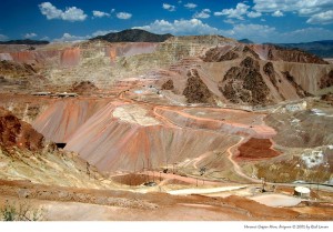
Morenci and neighboring Clifton share a common history of copper mining, and are today commonly referred to as the Clifton-Morenci district. Copper was discovered in Morenci in 1872 and mining began the following year. Both towns have had a cyclical history of booms and busts, and today downtown Clifton is nearly abandoned, with most economic activity centered in Morenci. The area’s largest employer is Freeport-McMoRan.

Geronimo is said to have been born near the current site of Clifton, and well-known southwest impressionist artist Ettore DeGrazia was born in Morenci.

Mt. Graham Golf Course

(Courtesy photo)

(Courtesy photo)


Mt. Graham Golf Course, located in the city of Thatcher, is a walker-friendly, traditional 18-hole par 72 course. For men, the course plays 6,354 yards, par 72 with a rating of 69.5 and a slope of 116. For women, its 5,691 yards, par 73 with a rating of 70.6 and a slope of 119. The course’s water and sand provide a great challenge for the average golfer.

There are active women’s and men’s golf associations and the course hosts several invitational tournaments each year including an annual Southwest Sectional PGA pro-am. The course also features a grass driving range and short game practice areas. Range balls are available at reasonable rates.

Mt. Graham Golf Course is home to the Safford and Thatcher High Schools and the Eastern Arizona College golf teams and is available for group outings and tournaments.

Casa Malpais near Springerville

Casa Malpais

(Courtesy photo: The Arizona Republic)

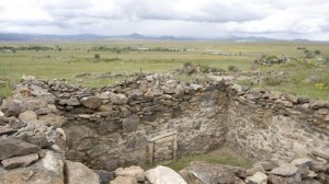
Casa Malpais was built around 1260 and was inhabited until about 1400. It is one of the latest dated Mogollon sites

Today, within 30 miles of Mountain Valley, located near the town of Springerville, visitors will find waterskiing, windsurfing and petroglyphs at Lyman Lake State Park, campsites, historical museums, hundreds of acres of National Forest offering tall pines and herds of elk and antelope.

The name Casa Malpais has been misinterpreted to mean “House of the Badlands,” but the name actually refers to the type of volcanic vesicular basalt rock, or Malapi, which the site is built on.

This site is surrounded by unusual beauty on a rim of volcanic rock overlooking the Little Colorado River’s Round Valley. The White Mountains lie to the south.

Natural fissures are located throughout the site. Evidence shows that these fissures were used for religious ceremonies as these people of the mountains struggled with the complexities of life and death in their harsh environment.

Both the Hopi and Zuni Indian tribes still consider Casa Malpais a sacred ancestral place.

The site features a solar calendar, a great kiva, ancient stairways, and rock art from the Mogollon culture. The Casa Malpais Visitor Center and Museum displays artifacts found at Casa Malpais and offers guided tours of the site that originate at the museum.

Fool Hollow Lake Recreation Area in Show Low

(Courtesy photo)

(Courtesy photo)


Operated by the Arizona State Parks, and located on the city of Show Low’s northern border, this recreation area was created by a private/public partnership in 1988 between the City of Show Low, U.S. Forest Service, Arizona Game and Fish and Arizona State Parks and private entities, with construction beginning in the fall of 1991.

It is an 850-acre recreation area surrounding a 149 acre lake and includes 92 recreational vehicle/camper hook ups, 31 developed tent sites, five shower buildings with rest room facilities, two handicapped fishing piers and a contact station. In addition, a fully functional sanitary dump station, a fish cleaning station and several tot lots are available to visitors with the project. Plans in progress include group campgrounds, nature center, amphitheater, two large grassy playing fields, picnic ramadas, hiking trails and playgrounds. Annual use permits are available through the Arizona State Parks, by contacting (520)537-3680.

Also located on the southern boundary of the city is Show Low Lake, operated by Recreation Resource Management under contract with the city of Show Low, are campgrounds and picnic areas.

Show Low Lake is located adjacent to Show Low Lake Rd about 1 mile from Hwy 260. It is a 100-acre lake that sits at an elevation of 6,500 ft. Adjacent to the lake is Show Low Lake Campground, a 75 site campground with some electric sites, dump station, shower facility, and small convenient store. The store rents boats, sells fishing licenses, bait, tackle, drinks and snacks. The campground also offers a playground, day use ramadas and group camping.   For more information you can call the park at 928-537-4126 or for reservations, please call 1-888-537-7762

White Mountain Wildlife and Nature Center

(Courtesy photo Arizona Game and Fish)

(Courtesy photo Arizona Game and Fish)


Take a break from the heat and get out into the cool pines of the Pinetop/White Mountain area. Through support of the community, the White Mountain Wildlife Nature Center complex is a facility devoted to being a one-stop source for all things environmental in Arizona’s White Mountains.

The community service goals of the center include:

-Integrating their work and the work of supporting organizations to educate visitors and encourage responsible action to better steward the natural resources in which we all share and care about.

-Be an economic benefit to communities they serve by providing additional revenues from areas outside of the White Mountains.

-Commit to, and advocate, sustainable multiple use of lands and resources.

-Serve the White Mountains as a wildlife rehabilitation center.

Several community events are planned throughout the year, which include AZ Game and Fish nature presentations, naturalist hikes, and more! For more information, visit http://www.whitemountainnaturecenter.org/.