Blog Posts Tagged ‘road-trip’

Kayenta-Monument Valley Scenic Road

Courtesy Photo VisitArizona.com

Courtesy Photo VisitArizona.com

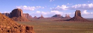
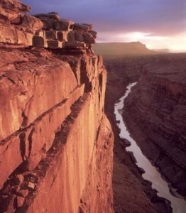
The breathtaking view of rocky formations jutting out of the desert floor, also known as Monument Valley, sits on the Navajo Indian Reservation in northern Arizona, attracting thousands of visitors every year. The scenery invites all to wander among the sandstone pinnacles with such names as The Mittens, Three Sisters, Totem Pole and Yeibichai. This is the land moviemaker John Ford made famous decades ago – the same land that helped make actor John Wayne a star. Travelers can see this homeland of the Navajos by journeying up US Route 163, the Kayenta-Monument Valley Scenic Road near the Arizona-Utah border, near the city of Page.

Beginning in 1939, the Westerns that Ford filmed featured the glory of red mesas , and while sparsely settled by Navajo sheepherders and a few others, became a mecca for sightseers and Old West buffs. Few places offer such a distinct link to the past. People first arrived in the region nearly 12,000 years ago when, archaeologists believe, nomadic tribes followed large game, like woolly mammoths, into the area. Over time, the game became smaller, the people more sophisticated.

Around A.D. 700, significant advances in weaponry and agriculture allowed people to settle permanently. The Anasazi, or ancestral Puebloans, with their superior hunting and farming techniques, developed the first stationary community in the region. Around A.D. 1250, the Puebloans moved from the area leaving their dwellings, now ruins throughout the Navajo Nation. Navajos entered the region later, sometime around A.D. 1500, though there are conflicting theories. Fighting over the land continued almost constantly – whether between different tribes, Spaniards, Mexicans or European-Americans – the region remained awash with turmoil for several centuries. It wasn’t until after the forced “Long Walk of the Navajos” into captivity in New Mexico in the 1860s that the Navajos returned home and witnessed the recognition of their land as sovereign.

The beauty of Monument Valley did not remain secret for very long. An archaeological expedition, funded by the American Museum of Natural History and headed by Charles L. Bernheimer, moved into the valley in 1927. With the help of John Wetherill, Bernheimer sought out sites such as Rainbow Bridge, an enormous natural, rocky arch that stretches 275 feet across at a height of 270 feet. Old Mike, a Ute Indian, then led the group to another natural bridge formation on June 8, 1927. Dubbed Clara Bernheimer Natural Bridge, after Bernheimer’s wife, the obscurely located arch hidden in the remote northern pocket of Arizona appeals to those with a taste for the extreme.
Fredonia-Vermillion Cliffs Scenic Road

Courtesy Photo ArizonScenicRoads.com

Courtesy Photo ArizonScenicRoads.com

This is the perfect trip for those who just to break away and go for a nice, long drive. This road traverses 82 miles along SR 89A between mileposts 525 and 607.

The Vermilion Cliffs highways is a project involving a partnership of 40 public and private entities providing a combination of 21 interpretive sites or scenic overlooks along 277 miles of state highways in northern Arizona and southern Utah.

The Vermilion Cliffs highways traverse some of the most scenic landforms in the West.

This scenic road is the gateway to the Colorado River in Marble Canyon and to the North Rim of the Grand Canyon. Heading north on this road from Bitter Springs on the Navajo Nation, travelers can stop at the Navajo Bridge.

Pipe Springs National monument is a historic Mormon settlement travelers can find along the way. Living history here depicts how an early Mormon settlement looked and worked in the 1800s.

Travelers will also pass through the town of Fredonia, Arizona, a town of less than one thousand residents.

The Grand Staircase- Escalante National Monument, a series of multi-colored cliffs can be seen rising to elevations of over 11,000 feet above the sea level.

Travelers will be encompassed with changing scenery with every mile they travel down this scenic road.

Apache Trail Historic Road

Photo Courtesy of Apache Trail Tours

Photo Courtesy of Apache Trail Tours

The Drive

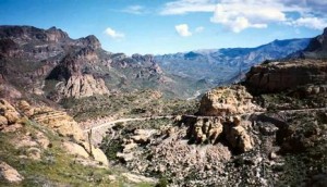
Just east of the city of Mesa, turning off at State Route 88 (Idaho Road) from State Route 60, is the historic Apache Trail. The 42-mile long trip offers a bumpy, back-door, Salt River route from Apache Junction, on the eastern outskirts of Phoenix, to Theodore Roosevelt Lake and then on to the mining town of Globe. The paved portion of the Apache Trail leads past a ghost town, a gold mine, a desert mystery and a cliff-sided lake.

Beyond the city lights and nearby residents of the East Valley, the Sonoran Desert  on display with yuccas and saguaros can be seen as you make the journey down a roller-coaster descent to a robber’s refuge, past a lazy lake, through a river canyon, and on to the extrinsically constructed dam, which paved the way to what Phoenix is today.

Patient drivers with no fear of heights are rewarded with three awe-inspiring desert lakes and the history and mystery of thousands of years of human adaptation to a volcanic landscape of drought, shard and thorn. The road, completed in 1905, initially used to aid in the construction of Roosevelt Dam, offers a jagged stretch of the Salt River, which first nourished a thousand years of Salado civilization, receives its waters from the White Mountains and the Mogollon Rim country.

The Lost Dutchman

The route continues to amaze with its rich history as you are lead past the touristy ghost town of Goldfield and then to the rugged Lost Dutchman State Park. Goldfield enjoyed a flurry as a gold-mining town in the 1890s when a rich gold strike supported a population of up to 5,000, and yielded about $1.5 million in bullion before the mine shafts flooded and the ore played out in 1897. The town revived a few years ago as a tourist attraction, with reconstructed buildings, exhibits and a simulated mine tour. The Mammoth Steakhouse and Saloon caters to meandering visitors, actors put on weekend gunfights, and mine tours offer a glimpse of the deadly life of a hardscrabble miner.

The Lakeviews

Apache Lake comes into view from a striking vista point. Protected by the harrowing drive and the minimal facilities, Apache Lake offers excellent fishing and some of the best lakeside camping opportunities in central Arizona. It has a marina, complete with boat rentals, a restaurant, fishing shop and motel rooms, but remains much less developed or visited than Canyon Lake. When full, Apache Lake stretches for 17 miles and measures 266 feet deep, although drought has lately lowered lake levels. Isolated stands of cottonwoods, accessible only by boat, provide good camping spots.

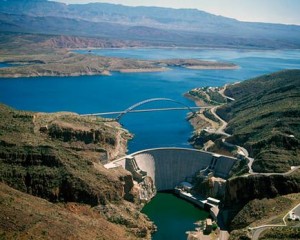
Roosevelt Dam. After a succession of floods and droughts repeatedly debilitated a string of farming communities along the Salt River in Maricopa County, a coalition of politicians, farmers and others convinced the federal government to build a massive dam on the river to control floods, store water and generate power

Photo Courtesy of US Bureau of Reclamation

Photo Courtesy of US Bureau of Reclamation

Roosevelt Dam

Faced with the floods and droughts, early Phoenix farmers pressed the federal government to build the dam that launched the reestablishment of the West. Roosevelt Dam created what was in 1911 the world’s largest artificial lake – Roosevelt Lake with a million-acre-foot capacity, a depth of up to 190 feet and 89 miles of shoreline. Wrestling the 344,000 cubic yards of masonry into place in the remote, flood-prone canyon proved unexpectedly dangerous. During construction, relying on an innovative 1,200-foot-long cable line with iron scoops that could hold 10 tons of rock and mortar, 42 men died.

Decades later, an analysis of the growth rings on ancient trees in cliff dwellings scattered throughout the Salt River watershed disclosed that the Salt River could generate much larger floods than the original dam engineers had anticipated. The discovery triggered in 1996 a $430 million upgrade of the dam, boosting its height 77 feet to 357 feet. The work included a $21 million, 1,080-foot-long bridge that stands as the longest, two-lane, single-span, steel-arch bridge in North America. The bridge, like a giant outstretched arm, reaches across the canyon of Roosevelt Lake, taking traffic off the top of the dam, which was barely wide enough to accommodate two Model T Fords abreast. Engineers significantly lowered the level of Roosevelt Lake during the project, and Arizona State University archaeologists conducted a series of archaeological digs around the lake. They found a huge complex of buildings that accommodated Salado farmers who irrigated with canals.

While it’s still unclear why the Salado Natives abandoned their homeland, this piece of mysterious history is tied into the rest of the amazing sights and antiquity – all on display along the Apache Trail.

Sky Island Scenic Byway

sky island scenic byway_southern_7.28.14

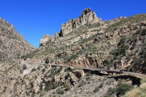
Climbing more than 6,000 feet,the Sky Island Scenic Byway begins with forests of saguaro cacti in the Sonoran Desert and ends in a cool, coniferous forest on the Santa Catalina Mountains. Prepare yourself for breathtaking views and a climate change that would be similar to driving from Southern Arizona to Northern Montana. Each thousand feet up is like driving 600 miles north offering a unique opportunity to experience 4 seasons in one trip.

The scenic drive begins at the outside edge of Tucson. If you are coming from I-10, take exit 256 and follow East Grant Road for 8 miles. Turn left onto East Tanque Verde Road and continue for three miles until East Catalina Highway on your left. The start of this scenic drive is in 4 miles as you enter the Coronado National Forest. This road is sometimes referred to as Mount Lemmon Highway or Hitchcock Highway.

If you are traveling this route in the winter, keep in mind that temperature differences from bottom to top is around 30 degrees and that upper portions may be closed due to snow. And in any season — bring water, extra clothes and gas up beforehand as there are no stations along the Catalina Highway.

As the road climbs among the Saguaro cacti and brittlebush, enjoy hairpin curves as you arrive at the Babad Do’ag Viewpoint (V1) which overlooks the desert cacti studded Tucson Valley, the Rincon Mountains, and the Tucson Basin. There are interpretive signs at the lookout and if you’re up for a longer hike — try the moderate 5-mile round trip Babad Do’ag Trail. Incredible desert vistas of saguaro, wildflowers and mountains await.

Continuing up the road, you enter the Molino Canyon. The road hugs the canyon’s cliff until the Molino Canyon Overlook (V2). The overlook offers a short hike to a creek and series of waterfalls. Towards the center of the canyon is the Molino Basin, home a campground and trailheads for a variety of hikes. Hiking here is especially fascinating due to the transition from desert to a forest dominated by cottonwood, oak, sycamore and willow trees within a very short distance.

Each turn of the road reveals a new perspective. As you enter Bear Canyon, the forest transforms once again into a lusher, cool environment with flourishing cypress, juniper, pine, sycamore, and walnut trees. Granite pinnacles soar into the sky, and with rocky outcroppings and stony hoodoos, some of Arizona’s best rock climbing is found here.

Next stop, Windy Point (V3) offers the most amazing views along the entire drive. Wind-whipped rock formations, views of the Huachuca, Patagonia, and Santa Rita Mountains, and the Tucson Basin await at 6,400 feet of elevation. On clear days, you may even see the Sierra de San Antonio in Mexico.

Geology Point Vista (V4), offers another spectacular viewpoint. Sweeping panoramas and precariously perched rocks create a surreal and photogenic landscape.

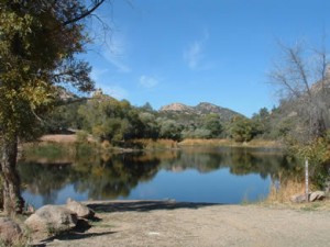
From here, you climb through forests of ponderosa pine. Rose Canyon Lake (W1) is stocked with trout and surrounded by absolute beauty; this seven-acre lake is a perfect stop for fishing, picnics, and camping in the Rose Canyon Campground. Keep an eye out for the turn off to Rose Canyon. Shortly afterwards, you arrive at the San Pedro Vista (V5) which overlooks the San Pedro River Valley, a desert between the Tortilla and Galiuro Mountains. From this stop, enjoy the 4-mile hike around Green Mountain to the General Hitchcock Campground.

Shortly after the viewpoint is the Palisade Information Center (I1). Self-guided displays inform about the Coronado National Forest and it’s a great location to get more information about hikes. Two of the most popular are the Butterfly Trail (H2) and Crystal Springs Trail (H3) with trailheads one mile from the center. Both trails are long, but you need not do the entire trail to enjoy the shaded, dense forests. Butterfly Trail (H2) features such a diverse biology, it has been designated a Research Natural Area. Wildflowers and butterflies are abundant and having a species field guide will come in handy. If you are up for a challenge, the medium-to-difficult Crystal Springs Trail will bring you to Mount Lemmon’s summit.

Experience the sky up close at the Mount Lemmon SkyCenter (A1). There are daytime and after-dark programs using their new 32-inch Schulman Telescope which is open to the public.

This scenic drive officially comes to an end as you arrive in the quaint town of Summerhaven, which features a General Store, shops and restaurants. While here, consider a few short side trips. For spectacular views in every season, Mount Lemmon Ski Valley, the southernmost ski area in the US, can be reached via East Ski Run Road. The ski hill offers an opportunity to ride the ski lift for breathtaking vistas at 9100 feet. Continue a few miles further and join onto Summit Road (T1). At the road end is the actual summit of Mount Lemmon, an amazing way to end this scenic drive.

Granite Basin

Photo courtesy of http://bit.ly/1uHpfJp

Photo courtesy of http://bit.ly/1uHpfJp

Granite Basin Recreation Area is the perfect hike for those who wish for an adventure beyond hiking. The public can camp, bike, fish, have a picnic and go horseback riding. Trails of the recreation include Balancing Rock Trail, Cayuse Loop, Clark Spring Trail, Hokaygon Trail, Metate Trailhead, Mint Wash Connector Trail, Surprise Spring Trail and West Lake Trail.


Kinder Crossing – Mogollon Rim

Photo courtesy of: http://bit.ly/1n3rVat

Photo courtesy of: http://bit.ly/1n3rVat

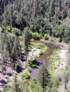
Hiking is, naturally, a very hot activity in Arizona. Kinder Crossing allows you to take a break from the heat with its picturesque access to East Clear Creek. Hikers of this trail can have a picnic and go swimming in the cool pools of water that align the hike.

Hikers of Kinder Crossing also get an awe-inspiring view of the Mogollon Rim. Limestone and sandstone steps offer the hikers footholds along a series of switchbacks.

World’s Largest Kokopelli

World Largest Kokopelli

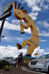
Located off of I-17, in Camp Verde, the World’s Largest Kokopelli sits in front of a souvenir shop luring travelers and tourists in to the parking lot of the Trading Post.

The giant statue is made from hand shaped and welded steel. Lowell Johnson, then owner of what at the time was the Montezuma Trading Post, came up with the idea to build the kokpelli. Prior to the kokopelli sat a hot pink 1920’s automobile in effort to attract tourists. Johnson, a local business man, and owner of the Oak Creek Terrace Resort, brought in an experienced blacksmith/artist and sketched out the design right on the sales counter. Made of 1/4 inch plate steel, the hand shaping and welding of the structure took weeks as the 12 cubic yard cement foundation cured. The statue’s instrument houses a speaker that plays music to visitors at they shop. By the end of the project, it had cost more than $25,000. For a while, there was a price tag hung in the event an interested buyer came along.

Titan Missile Museum

titan missle museum_southern_7.28.14

Bomb shelters, the Berlin Wall, weekly tests of the Emergency Broadcast System, the piercing sounds of air raid sirens, and the Space Race. These are the hallmarks of the “Cold War” era.

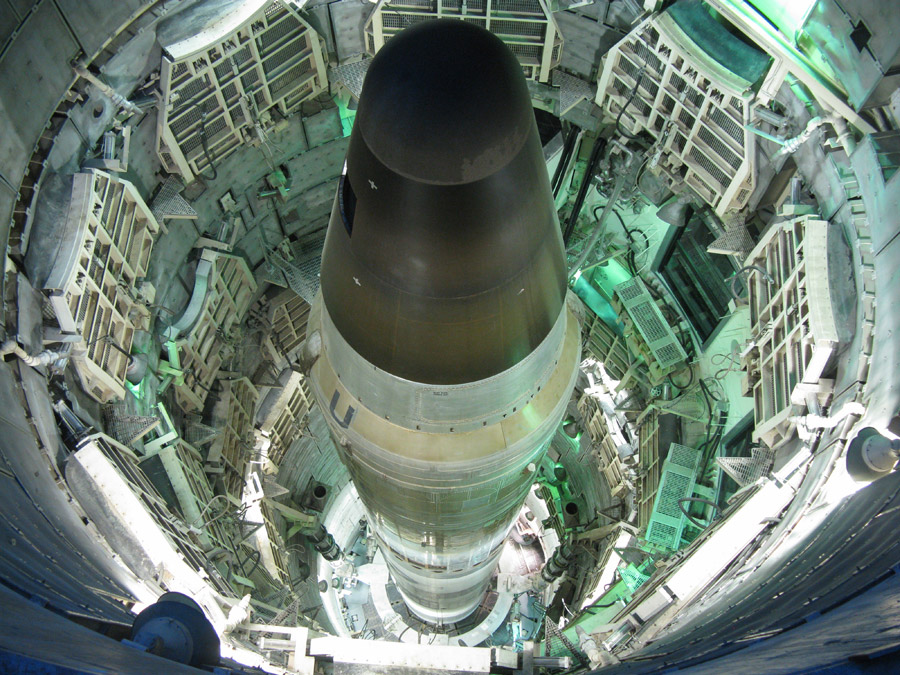
The Titan Missile Museum, located in the town of Green Valley, showcases the dramatic vestiges of the Cold War between the U.S. and former Soviet Union and provides a vivid education about the history of nuclear conflict-a history of keeping the peace.

Visitors enjoy a journey through time as they stand on the front line of the Cold War. This preserved Titan II missile site, officially known as complex 571-7, is all that remains of the 54 Titan II missile sites that were on alert across the United States from 1963 to 1987.

Able to launch from its underground silo in just 58 seconds, the Titan II was capable of delivering a 9-megaton nuclear warhead to targets more than 6300 miles (10,000 km) away in about 30 minutes. There is no other place in the world where visitors can get this close to an intercontinental ballistic missile in its operational environment. This one-of-a kind museum gives visitors a rare look at the technology used by the United States to deter nuclear war. What was once one of America’s most top secret places is now a National Historic Landmark, fulfilling its new mission of bringing Cold War history to life for millions of visitors from around the world.

http://www.titanmissilemuseum.org/

Copper Queen Mine

Queen Mine Tour

A life of a miner has never been an easy one. Miners spend their days in darkness doing grueling labor at a menial salary. Being a miner requires much strength, endurance and willpower. The Copper Queen mine once hosted such hardworking men and today, the Bisbee mine remains open as a tourist destination.

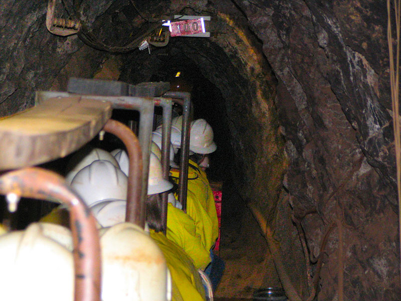
The Copper Queen Mine was one of Bisbee’s richest mines that operated from 1877-1975. Visitors get to learn all about the mine and about the people who spent many hours within it during the Copper Queen Mine Tour. This tour allows visitors to step back into the past as they adorn a hard hat, miner’s headlamp and yellow slicker throughout the tour. Tour guides lead groups 1,500 feet into the mine and recount mining days, techniques, dangers and drama. Visitors will even get to experience first-hand what it was like to work underground.

Kartchner Caverns


Escape the Arizona heat by going down under and taking a tour into the incredible Kartchner Caverns.

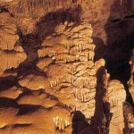
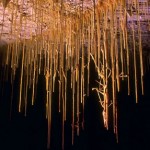
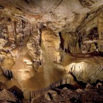
Discovered in 1974, Kartchner Caverns is home to remarkable minerals and formations

The caverns are carved out of limestone and filled with spectacular speleothems which have been growing for 50,000 years or longer. This tourist site holds the world’s largest stalactite formation. (A stalactite is a type of formation that hangs from the ceiling of caves, hot springs, or manmade structures such as bridges and mines.)

The 23,000-square-foot Discovery Center is another must-see at Kartchner Caverns. The center explains many aspects of the cave, including geology, the bat population and paleontology. Interactive exhibits help to explain the discovery of the cave and how formations develop.