Blog Posts Tagged ‘historic’

Downtown Williams Recalls Route 66

An evening glimpse at Downtown Williams.  Photo from the City of Williams

An evening glimpse at Downtown Williams. Photo from the City of Williams

Route 66 conjures thoughts of rich history, neon lights, classic cars and fun for the whole family.  Williams was the last town in America on Historic Route 66 to be bypassed by the I-40 freeway in October 1984.  Only in Williams will you enjoy the beauty of a mountainside town, the best-preserved stretch of Route 66, outdoor adventure to suit every need, a railway to get you to the Grand Canyon in style, an outdoor drive-thru wildlife park, a true western setting with cowboys swaggering through town, and a friendly atmosphere greeting you the moment you arrive and bidding you farewell when you depart.

BLOG_DowntownWilliams002

Williams was the last town in America on Historic Route 66 to be bypassed by the I-40 freeway. Photo from City of Williams

Some of those same motor hotels from back in the day have been revitalized with all the comforts modern travelers expect and the storefronts of Main Street are preserved as a designated National Historic District. With its preservation of an authentic small town atmosphere and history, Williams is the perfect place to “Get your kicks on Route 66” before you visit the Grand Canyon and after!

Williams has the best-preserved stretch of the Historic Route 66.  Photo from the City of Williams

Williams has the best-preserved stretch of the Historic Route 66. Photo from the City of Williams

West Comes to Life in Downtown Wickenburg

A sign and statue greet visitors on U.S. 60 entering Downtown Wickenburg.  Photo from the City of Wickenburg

A sign and statue greet visitors on U.S. 60 entering Downtown Wickenburg. Photo from the Town of Wickenburg


Wickenburg boasts one of the American West’s classic downtowns, featuring unique shops, eateries, public art, and activities. Decades of investment in streetscape improvements by the town have made Wickenburg a popular destination among tourists and Arizona natives alike, who flock to the community for its cowboy culture and Western charm.

Ben's saddlery  Photo from the Town of Wickenburg.

Ben’s Saddlery is one of the longest-operating businesses in downtown Wickenburg. Photo from the Town of Wickenburg.

The Atchison Topeka & Santa Fe steam locomotive No. 761 sits near the original train depot, which now serves as the Wickenburg Visitor Center and Chamber of Commerce offices.  Photo from the Town of Wickenburg.

The Atchison Topeka & Santa Fe steam locomotive No. 761 sits near the original train depot, which now serves as the Wickenburg Visitor Center and Chamber of Commerce offices. Photo from the Town of Wickenburg.

Visitors can explore the downtown’s public art, including life-size sculptures depicting scenes of the old west. The Desert Caballeros Western Museum, a world-renowned fine art institution, also resides downtown just a short walk from the visitor center in the old train depot. During the busy season, team roping at two nearby arenas is in full swing, and popular events such as the annual Gold Rush Days celebration fill the downtown with excitement.

The Hassayampa River Walk, completed earlier this year, is an adaptive reuse of the 1962 ADOT bridge over the Hassayampa River that hosts downtown events.  Photo from the City of Wickenburg

The Hassayampa River Walk, completed earlier this year, is an adaptive reuse of the 1962 ADOT bridge over the Hassayampa River that hosts downtown events. Photo from the Town of Wickenburg.

In May 2015, the town completed the Hassayampa River Walk, an adaptive reuse event space overlooking the Hassayampa River.

A statue sits in the roundabout connecting US 93 and US 60 at the entrance to downtown Wickenburg.  Photo from the Town of Wickenburg.

A statue sits in the roundabout connecting US 93 and US 60 at the entrance to downtown Wickenburg. Photo from the Town of Wickenburg.

Culture and Connection in Downtown Nogales

Skyline view of Downtown Nogales.  Photo from the City of Nogales

Skyline view of Downtown Nogales. Photo from the City of Nogales

At the southern point of Arizona, just a stone’s throw from Mexico, the City of Nogales is a center of culture and connection. Downtown Nogales is filled with historic architecture, unique local stores and restaurants, and picturesque views.

Morley Avenue is home to classic boutique department stores and local shops, serving as the nucleus of the Nogales Downtown. Owners of the shops hail from all over the world, each with a unique story and collection of goods. Avenida Obregon is a peek at another world of shopping – small shops, vendors, restaurants and clubs give this area character of “Old Mexico” and many annual festivals are held right here.

Nogales City Hall serves as the political center of the city. Photo from City of Nogales.

Nogales City Hall serves as the political center of the city. Photo from City of Nogales.

The park in front of City Hall boasts the Santa Cruz County Wall of Honor, a splash pad for children, and an LED fountain. Photo from City of Nogales.

The park in front of City Hall boasts the Santa Cruz County Wall of Honor, a splash pad for children, and an LED fountain. Photo from City of Nogales.

Visitors will also experience history and architecture, with the Historic 1904 Courthouse and Old City Hall and Pesqueria and Ochoa Plazas offer areas of activity, arts and culture for visitors and residents alike.

Historic 1904 Courthouse, an architectural masterpiece that houses a gorgeous period courtroom.  Photo from the City of Nogales.

Historic 1904 Courthouse, an architectural masterpiece that houses a gorgeous period courtroom. Photo from the City of Nogales.


Downtown Kingman Brings Route 66 to Life

Kingman hosted the International Route 66 Festival in 2014.  Photo from the City of Kingman.

Kingman hosted the International Route 66 Festival in 2014. Photo from the City of Kingman.

Photo: Kingman_002.jpg Caption: Downtown Kingman.  Photo from City of Kingman.

Photo: Kingman_002.jpg
Caption: Downtown Kingman. Photo from City of Kingman.

Visitors and residents alike have been enjoying the historic architecture, community events, and businesses in Kingman’s revitalized downtown. In 2014, Kingman hosted the International Route 66 Festival, which brought 8,000 attendees from 24 different counties to downtown to celebrate the historic road. This year Kingman combined the celebration of Route 66 and classic cars with its love for rodeo in the Inaugural Best of the West on Route 66 Festival September 25 -27.

Kingman Club. Photo from City of Kingman.

Kingman Club. Photo from City of Kingman.

In addition to public events, two event centers have opened in previously vacant historic buildings and are available for private parties, weddings and community fundraisers. The success of events in historic downtown could not have taken place without many improvements, beginning with the elimination of non-emergency train whistles. The reduction in noise also led to the opening of several new businesses including a boutique hotel, restaurants and bars. Beautification projects including ADA compliant upgrades and repairs to the sidewalks, park improvements, and abatement projects have helped create a welcoming atmosphere to compliment the area’s growth.

Photo: Kingman_004.jpg Caption: Hilltop Motel in Kingman. Photo from City of Kingman.

Photo: Kingman_004.jpg
Caption: Hilltop Motel in Kingman. Photo from City of Kingman.

Cottonwood Historic Road

cottonwood historic road_prescott area_8.4.14

Image courtesy of sangres.com

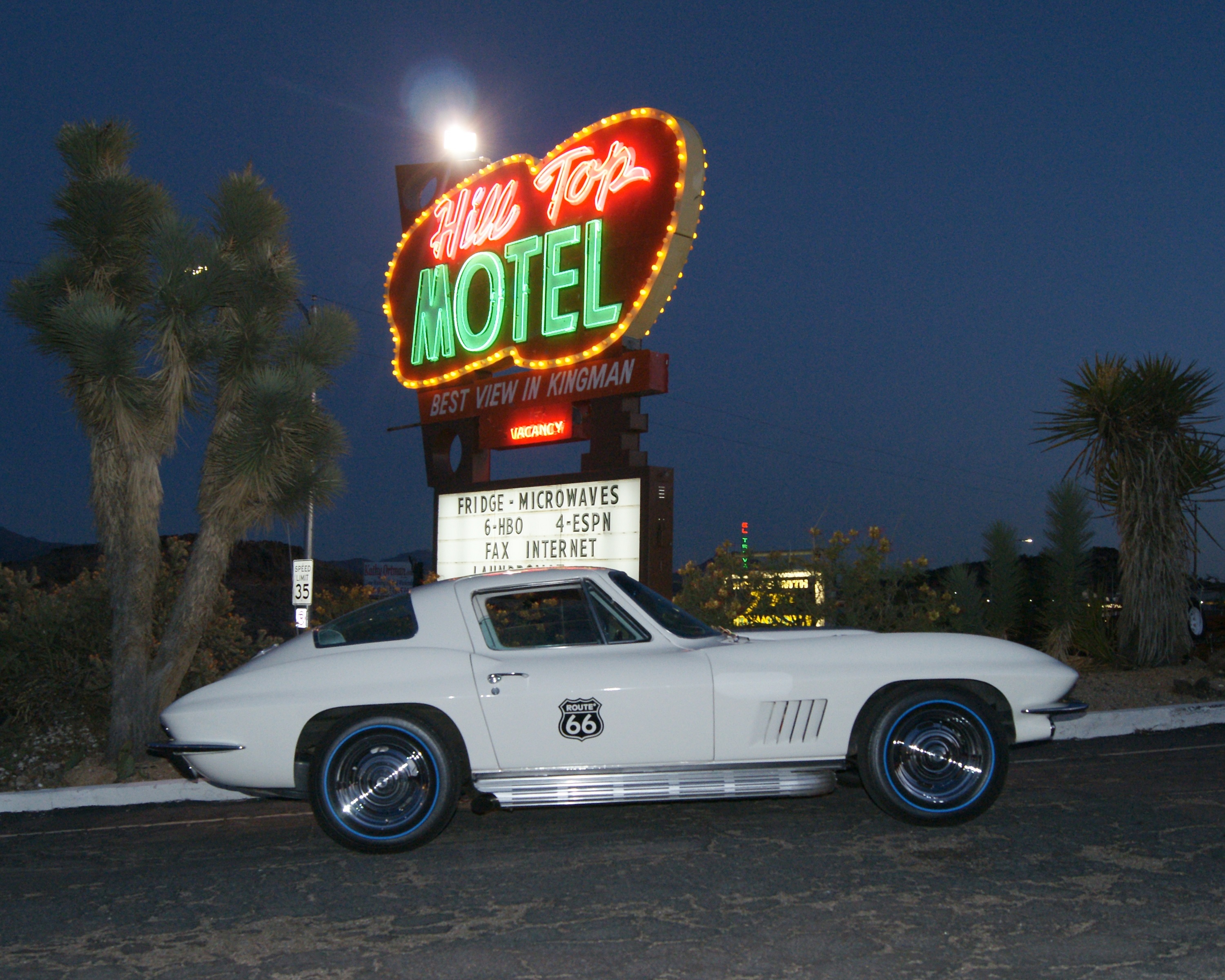
A scenic stretch of State Route 89A — the Jerome-Clarkdale-Cottonwood Historic Road — overlooks the Verde River Valley, exposing spectacular views of the Mogollon Rim and Colorado Plateau. As travelers approach from Prescott on State 89A, a steep drop followed by a final hill pitches right onto Main Street in the heart of Jerome and the start of the historic road designated in May 1992.

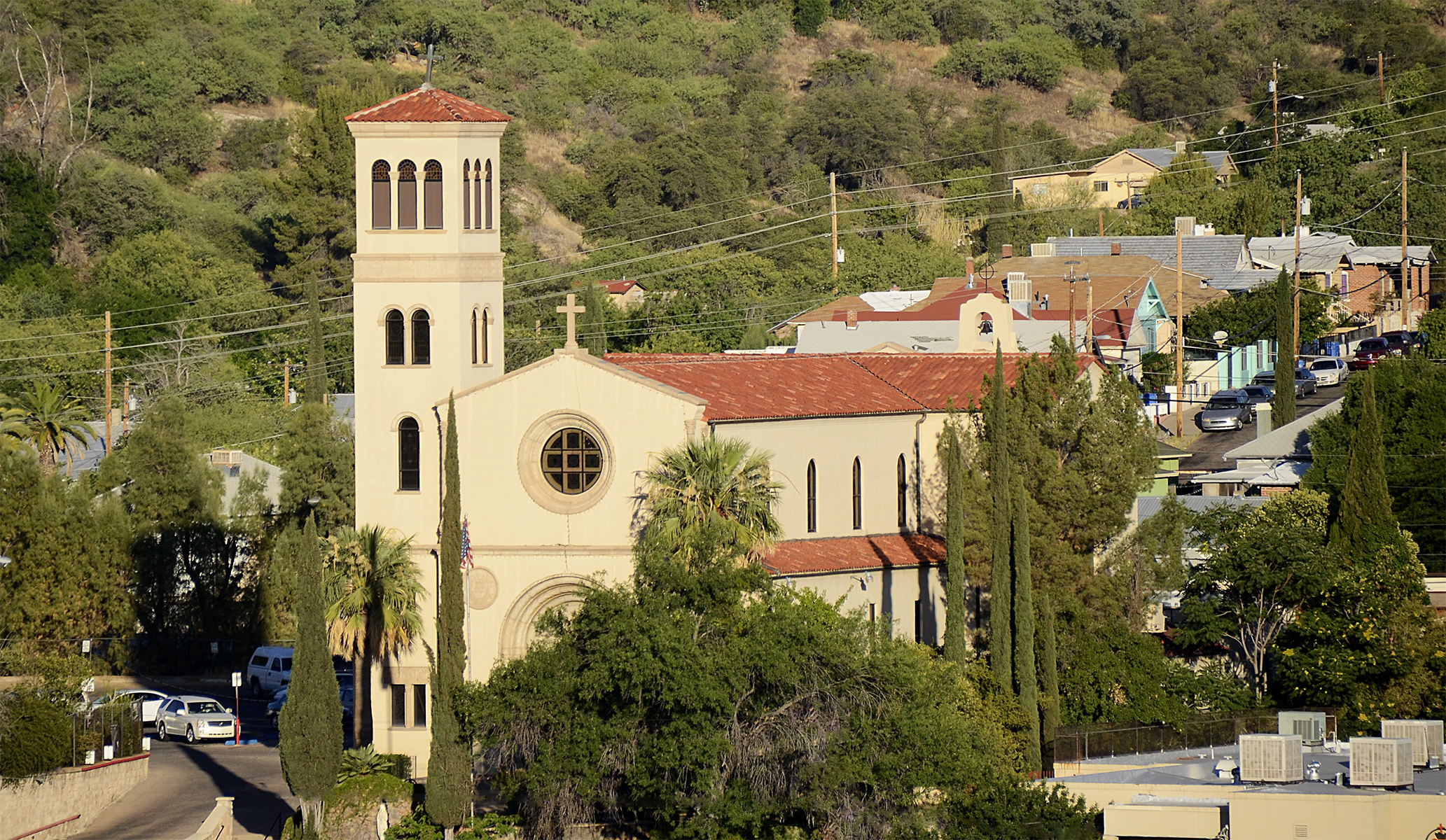
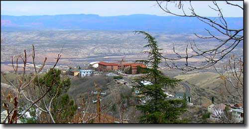
The once-roaring mining community became a ghost town and then transformed into today’s thriving art community, all while clinging precariously to the side of Cleopatra Hill. Buildings balance cautiously, clutching the steep grade. Retaining walls and flat pads hold some structures in place, while others hang on at seemingly impossible angles. Headlines in the February 5, 1903, issue of the New York Sun read, “This Jerome is a Bad One — The Arizona Copper Camp Now the Wickedest Town.”

Jerome started as a mining camp, nothing more than a settlement of tents. But the surrounding hills were full of copper, and soon a lawyer named Eugene Jerome invested $200,000 in a mining operation to extract it. His claim would eventually make Jerome one of the largest towns in Arizona. He also hired a surveyor to lay out the twisted town of Jerome, a namesake he insisted upon although he never visited there.

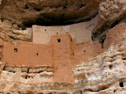
But Eugene Jerome wasn’t the first to discover the abundance of minerals in the Black Hills. Indian tribes in the region were well aware of the riches beneath the mountains long before the Europeans and Spanish entered the area. Somewhere around the year AD 1125, the Sinagua Indians appeared in the Verde Valley, a lush forested land with a dependable water source in the rushing green-blue of the Verde River. They lived a prosperous life, trading with tribes more than 100 miles away and farming the rich valley. Around the year AD 1400, the Sinagua people inexplicably began to migrate from the region. By the year AD 1450, they had disappeared, but left behind a dwelling now called Tuzigoot, an Apache word for “crooked water.”

The 110-room, two-story ruin perches atop a hill between the towns of Cottonwood and Clarkdale. The Sinagua Indians knew of the minerals in the hills and used them to trade for other necessities and pleasures of life, like copper bells and pottery more elaborate than their own brown clay and volcanic ash pieces. Occasionally they used azurite, a mined copper carbonate with a deep-blue hue, to paint their pottery. The museum at Tuzigoot National Monument displays some of their jewelry.

After the Sinagua people disappeared from the area, Spanish explorers stumbled across the land following tales of gold-laden cities and mines with rich veins of colored ore. Many years later, the first American prospectors came, soon to uncover and exploit the multitude of riches buried deep in the Black Hills. On a search for gold in 1583, Spanish explorer Antonio de Espejo and his companions traveled through the desert surrounding Jerome and the Black Hills. Greeted by the Indians of the region who gladly showed the explorers their own mining efforts in the hills, the Spaniards had their hearts set on gold. When they realized the Indians were mining mainly copper, they decided to move on, but claimed the land in the name of Spain. They were unaware of the great fortunes that lay waiting just below their feet — copper mostly, but also silver, gold and zinc.

In 1598, Marcos Farfan, also a Spanish explorer, crossed the area looking for gold. He, too, claimed the mines for the Spanish crown, but the rough mountains deterred him. The small amount of gold mixed in with the copper, he believed, was not worth the great effort to remove it. After these two explorations, it would be almost 300 years of only scattered visits from the Spaniards and Anglos before the mad rush for riches brought the miners that would change the area forever.

American settlers arrived in the Verde Valley in 1865, wandering in from the Prescott Valley area. Small-scale mines attempted to extract the precious metals from the mountains, but the difficult desert terrain and rocky mountainsides made excavation uneconomical. Finally a group of prospectors, including future Territorial Governor Frederick A.Tritle, acquired an interest in some of the claims. The work was hard and hot, and the men made $80,000 before transporting the ore became too expensive to continue.

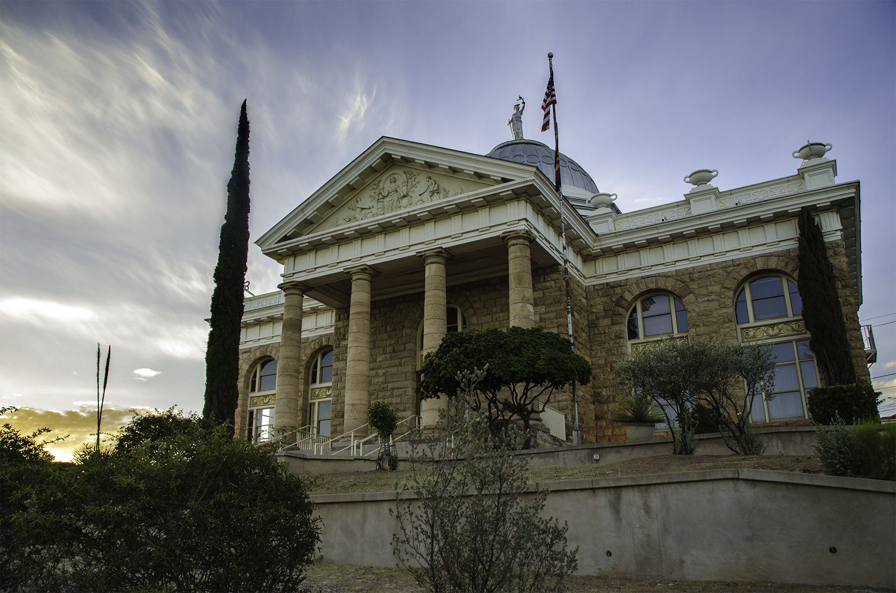
Enter Eugene Jerome, a New York moneyman looking for an easy buck. His investment gave the first breath of life to the United Verde Copper Co. and the twisted face-lift of rickety buildings and zigzag roads that adorn Cleopatra Hill. Jerome owned it all — the mining operation and the town — but in 1888 he sold it to William Andrews Clark, a US senator from Montana and a copper mogul who knew exactly what it would take to profit from the mines in Jerome, and he had the capital to make it happen. Fires deep in the mines forced the company to begin open-pit mining, and the old smelter that sat on top of the mines had to be removed. Clark started construction on a new smelter in 1910 just down the road from Jerome, and then in 1914 built a town around it named Clarkdale. Clarkdale’s historic district is now listed on the National Register of Historic Places as one of the first successfully planned company towns. Clark also financed a narrow-gauge railroad line to connect to the Santa Fe railroad, forging the final link to the outside world.

When the mine pumped profits into Clark’s pockets and attracted miners looking for work, the entrepreneurs came also. Bars, brothels, hotels, saloons and boarding houses all popped up, and Jerome became the bad, brawling, billion-dollar mining town that endured many mining deaths, smallpox and scarlet fever epidemics, and a series of devastating fires that ravaged the mountainside buildings between 1897 and 1899. But Jerome survived. The town incorporated in early 1899 and established the Jerome Volunteer Fire Department as well as a building code advising construction with brick and stone to help prevent further fires.

By the 1920s, Jerome had a population of about 15,000 and was the largest copper-producing area in Arizona, but production slowed with the Great Depression of the 1930s. The mine came into the hands of the Phelps Dodge Corp., which still owns it. During the 1930s Phelps Dodge used dynamite blasts in the open pits to go deeper for ore, and in the process made Jerome a “moving” community — literally. Shifting earth caused by the great blasts made parts of the town crack and slide. One large blast caused an entire downtown block to slide one level down the mountain, and resulted — to some amusement — in the relocation of the town jail, which slid a full block from its original site.

The increased demand for copper during World War II revived the mine for a while, but in 1953 the mine closed after more than 70 years of production. Approximately $800 million in copper had been taken from the veins of the mighty mountains. With the closing came the inevitable death of the town as a mining center as miners dispersed across the Southwest looking for work. The 50 to 100 diehards who remained began promoting Jerome as a ghost town, and in 1967 the US government declared Jerome a National Historic Landmark.

Despite the ravaging fires that destroyed much of Jerome in the late 1890s, many of the original buildings still stand and many more have been restored. The spicy flavor of a wild mining environment still permeates the town. Today, known primarily as a tourist attraction and art community, Jerome greets approximately a quarter of a million visitors a year. Leaving Jerome, the first 6 miles of the drive to Cottonwood drop steeply and offer awe-inspiring views of the Mogollon Rim and the Verde Valley. Surrounded by mesas and buttes to the north, and jagged mountains in every other direction, Cottonwood got its name from the cottonwood trees that grow along the Verde River, which runs right through the town.

Cottonwood began as a camping place for travelers headed for Oak Creek and Camp Verde, and was a main crossing place on the Verde River. The first Anglos to settle here were soon followed by soldiers from nearby Fort Whipple, who were sent to protect ranchers in the Verde Valley. The fertile land soon attracted other ranchers and farmers, and a small farming community sprung up.

Today, Cottonwood has a population of about 5,900. A quaint area known locally as Old Town is officially Cottonwood Commercial Historic District. Walking tours are offered as are self-guided tours of the Verde River riparian area. At the end of the Jerome-Clarkdale-Cottonwood Historic Road southeast of Cottonwood, the next leg of the journey starts toward Sedona — the Dry Creek Scenic Road.

Article courtesy of Arizona Scenic Roads.

Jerome Grand Hotel

Photo courtesy of jeromegrandhotel.com

Photo courtesy of jeromegrandhotel.com

Jerome, Arizona, was once a copper mining camp. It saw as many as 10,000 residents. But, during the Great Depression, ore deposits were exhausted and mines were shut down. The population dwindled quickly and was made up of less than 100 people by the 1950s.

The city now resides as a National Historic Landmark. Within it, at one mile high stands the Jerome Grand Hotel. As guests walk through the hallways of this historic hotel, they’ll not only get a glimpse into the Jerome past but also have the chance to experience something paranormal.

The hotel is said to be haunted. This is because, before it was the Jerome Grand Hotel, it was the United Verde hospital. Guests of the hotel have said to have heard coughing, labored breathing and even voices coming from their empty rooms. Some have even reported light anomalies and the television sets turning themselves on with no explanation.

Those who wish to stay at the Jerome Hotel can choose the hotel’s ghost-hunting package. In this package, guests are invited to help with the hotel’s ongoing investigation of the supernatural and paranormal activities. The hotel provides ghost hunters with an MET meter, IR thermometer and digital camera to help the hotel document the spirits, orbs, ghost sightings and haunted happenings.

Clarkdale Copper Museum

copper art museum_clarkdale_7.29.14

Image courtesy of tripadvisor.com

Just as Arizona is known as the “copper state,” it stands to reason that there should be a copper museum. While North America in itself is the largest copper producer in the world, Arizona sits on top amongst the states in being at the heart of copper production.

Most times when one encounters a museum – especially devoted to a natural resource – one would envision displays of pieces of the resource in its natural form, in small and large exhibits. However, this building of unique metal history shows through the Ages what man has done with the metal – “art of the average Joe” is what it could be deemed.  Out of the seven primary natural metals, copper was discovered in 9000 B.C. and its first use was in the form of weapons. Going from there, people constructed various items out of copper as well, to include kitchen and shop tools, and architecture.

The exhibits reveal copper art and collections for study, which were created by coppersmiths, soldier artists and braziers; many of whom were masters in their trade.  In addition, copper artifacts with an emphasis on American and European works-of-art from the 16th to the 21st century are all on display in this multi-room facility.

The Copper Art Museum is a new museum with roots that can be traced back to 1919, where an antique shop was located in Northern Minnesota.  In the early 1960’s copper wares were collected throughout Europe and later sold in the U.S.A. at on-the-road shows throughout the Midwest during the 1970’s.  The 1980’s – 90’s saw an increase in purchases and sales of copper artifacts from Europe and the U.S.A.

In the early 2000’s the collection was so large that plans of a museum came to life and a location was sought.  Later Clarkdale, Arizona was chosen as the site for a museum of copper art showcasing Arizona’s most precious treasure.

Montezuma Castle

montezuma castle_2_verde valley_8.4.14

On December 8, 1906, President Theodore Roosevelt celebrated the passage of the Antiquities Act by declaring four sites of historic and cultural significance as our nation’s first National Monuments. Among these was Montezuma Castle, which the President identified as a place “of the greatest ethnological value and scientific interest.” Although very few original artifacts remained in the structure due to intensive looting of the site, Roosevelt’s decision assured the continued protection of one of the best preserved prehistoric cliff dwellings in North America. Montezuma Castle National Monument quickly became a destination for America’s first car-bound tourists. In 1933, “Castle A”, a 45-50 room, pueblo ruin was excavated, uncovering a wealth of artifacts and greatly enhanced our understanding of the Sinagua people who inhabited this riparian “oasis” along Beaver Creek for over 400 years. Early visitors to the monument were allowed access to the structure by climbing a series of ladders up the side of the limestone cliffs. However, due to extensive damage to this valuable cultural landmark, public access of the ruins was discontinued in 1951. Take a stroll through time, while enjoying the canopy of trees that shade the walkways, as you gaze at the amazing cliff dwellings, or walk over to the adjoining creek to learn how the Sinuagua people relied heavily on this precious water source for survival. Now, approximately 350,000 people a year gaze through the windows of the past during a visit to Montezuma Castle. Even 600 years after their departure, the legacy of the Sinagua people continues to inspire the imaginations of all.

Copper Creek/ Sibley Mansion

sibley mansion_2_8.4.14

Photo courtesy of americansouthwest.net

The Sibley Mansion was home to Roy and Belle Sibley. Roy was a mining company managers and his wife was the town’s first postmaster. In 1908, the Sibleys started their work on the mansion. There were 20 rooms within the mansion, it was built of stone and had polished oak floors, picture windows and full-length mirrors. The mansion was the center for social activities in the area. It is rumored that the Sibleys entertained some of the social elite including the governor of Arizona. While the Sibleys moved out of the home in 1910, Martin Tew turned the property into a ranch and called it Monte Bonito in 1917. Tew was a nature lover and wrote poetry, which he shared with others by leaving it on trees for people to read. In 1933, the Arizona Molybdenum Corporation was mining in the area. When the San Diego Union reported Copper creek as a town that was crime-ridden and wild, residents cleared the town out and businesses, including those at Copper Creek, closed. Copper Creek/ Sibley Mansion is brought back to life as residents venture to see the spectacular piece of historic Arizona. The trail begins at the intersection of River Road and Copper Creek Road. Visitors are to tread cautiously, though, as there is active mining and cattle ranching in the area.

Tumacacori National Park

Tumacacori National Park_southern_7.28.14

This historic park preserves the ruins of three early Spanish colonial missions. The area was originally visited by the Jesuit Father Eusebio Francisco Kino in 1691. The King of Spain expelled the Jesuits and replaced them with Franciscans in 1767 and construction was begun by the Franciscan Catholics on the massive adobe church about 1800, but it was never finished.

The Tumacacori National Monument (now the National Historical Park) was established in 1908

These ruins and the culture among it has changed over time; people are encouraged to visit and experience this changing heritage. The unique park also provides opportunities for walkers, bird-watchers and equestrians. There is a popular 4.5-mile stretch of trail between Tumacacori and Tubac for those looking for a good hike filled with remnants of Arizona’s past.