Blog Archive for the ‘The Great AZ Road Trip’ Category

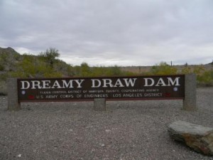
Dreamy Draw Dam

Photo Courtesy of Phoenix New Times

Photo Courtesy of Phoenix New Times

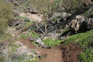
Like the lore of those mysterious Phoenix lights, some things are just more amusing when left unexplained. The Dreamy Draw Dam is possibly one of those things. Located on the side of Piestewa Peak, Dreamy Draw is a recreational area in the city of Phoenix, providing the perfect location for laid-back hikes and family picnics. What makes Dreamy Draw just a little more interesting is its supposed background in an alien-associated account. Just weeks after the theoretical 1947 spaceship sighting in Roswell, New Mexico, a flying saucer reportedly crashed right in Phoenix’s backyard at the Dreamy Draw. Many believe the Dreamy Draw Dam was constructed to keep onlookers from discovering more about the believed extraterrestrials.

In the early 1900s, the area of the Dreamy Draw was found to have cinnabar, a type of mercury sulfide, and for years, served as a mining site. Because of the toxicity of the mercury, many of those miners experienced sickness, including hallucinations. Many others believe that the alien life forms just stemmed from the imaginations of those working near the site.

Several theories remain about the supposed UFO visit, but one fact remains true: Dreamy Draw offers plenty of recreational activities that are out of this world.

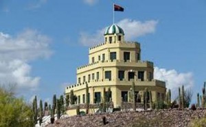
Tovrea Castle

Photo Courtesy of Greater Phoenix Convention & Visitors Bureau

Photo Courtesy of Greater Phoenix Convention & Visitors Bureau

The Tovrea Castle is not like the castles that were built in the Middle Ages. The walls of this castle don’t tell tales of nobility. Instead, these walls tell tales of unfulfilled dreams.

The castle, which today resembles that of a traditional wedding cake, was built by Italian immigrant Alessio Carraro. In 1928, Alessio moved to Arizona with dreams of developing a resort destination and housing subdivision known as Carraro Heights within Phoenix. The centerpiece of his vision was a hotel, which is the main structure we see today.

Carraro’s dreams never came to fruition as the hotel and property were sold in 1932. It is unknown what exactly squandered Carraro’s dreams.

The Castle was bought by the Tovrea family and eventually by the city of Phoenix. Today, visitors of the castle can tour its gardens; walk-in tour requests are based on availability only. There are no tours in the months of July or August.

Governor Hunt’s Tomb

Photo Courtesy of City of Phoenix

Photo Courtesy of City of Phoenix

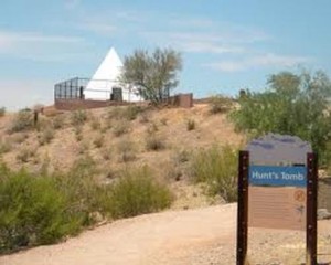
Located in Papago Park, next to the Phoenix Zoo is Gov. Hunt’s Tomb. A tall, white pyramid atop a small hill, nestled next to the red buttes of the park. Arizona Gov. George W.P. Hunt was dubbed “King George VII,” with an impressive track record of being Arizona’s 1st, 2nd, 3rd, 4th, 7th, 8th, and 10th governor, which stands to show why he was considered “friend of the common man.”

When Hunt’s wife died in 1931 he had her buried on the hill in Papago Park, in a 20-foot-tall pyramid faced with solid white tile. When he died three years later he joined her, and was later joined in turn by his in-laws, his wife’s sister, and his daughter. Plaques on his pyramid declare that he was a descendant of an unnamed “Revolutionary War patriot,” that he allowed women to vote in his state eight years before the rest of the country, and that he was elected governor seven times, which “set a national record.”

The tomb was listed on the National Register of Historic Places in 2008, and can be seen from anywhere in Papago Park, offering a panoramic view of the eastern part of the Valley of the Sun

Phoenix Hiking

Photo Courtesy of City of Phoenix

Photo Courtesy of City of Phoenix

Camelback Mountain

With an elevation of 2,704 feet, and a 360-degree view of the Valley at its highest point, Camelback Mountain is an excellent hike or climb in Arizona, especially when you do not want to venture too far, and want to do a much quicker hike – as opposed to all day. Camelback Mountain is located in the Camelback Mountain Echo Canyon Recreation Area between Phoenix, Scottsdale and Paradise Valley.

There are 2 hiking trails, Echo Canyon and Cholla, and while both trails are rather difficult, the exhilaration once you’ve completed and gone to that highest point with a view of the entire city, its worth it! For first-timers, you can schedule a guided hike up Camelback Mountain, read about other hikers’ experiences, as well as post your own.

Piestewa Peak 

What once was an old horse trail and trail for mining is now a varying, beautiful, and challenging trail. Start first thing in the morning and when you get to the top enjoy the array of colors illuminating the sky, or do this as a means to get your cardio-workout in. Whatever you decide, the trail is comparative to Camelback with its difficulty level, but just as equal with its luscious desert backdrop and view of the city from the north.

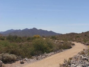
Its highest peak is at 1,208 feet, and approximately fifteen miles of interconnecting trails in the Preserve, ranging from easy to difficult, one can easily spend only 30 minutes to several hours hiking and taking in the sights.

Photo Courtesy of AZ Central

Photo Courtesy of AZ Central

South Mountain 

With 70 miles-worth of trails to choose from, and ranging from easy to skilled, South Mountain is another great place to hike and stay close to the Phoenix area. Located at Central Avenue, south of Dobbins Road, the trails can very easily take you a short distance of mostly even-surface, to rugged, multi-leveled trails for the avid hiker or mountain biker. If you’re feeling a wild hair, hike to the top where you will get a gorgeous view of the city on one side and the other a serene view of the northernmost part of the Gila River Reservation where peaceful scape of the outstretched horizon can be seen for miles. While this can be an enjoyable hike for many, it is forewarned that these trails are underdeveloped and wildlife is very much a part of the area, so take caution!

Hiking in Phoenix: https://www.phoenix.gov/parks/trails/ 


Peoria Sports Complex

Photo Courtesy of Arizona United

Photo Courtesy of Arizona United

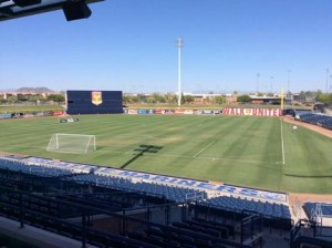
The World Cup may be over, but the soccer sensation is alive and well in Peoria, Arizona. Keep that momentum of cheering for your team by heading to the Peoria Sports Complex to catch a match of the United Soccer League’s Arizona United Soccer Club.

In early spring, the complex serves as the spring home to the Seattle Mariners and San Diego Padres Major League Baseball teams. It also is a community gathering place for special events like the Peoria All America Festival and Halloween Monster Bash.

For the summer months, the baseball stadium becomes a soccer field where Arizonans can experience World Cup fever all summer, every summer. So come on out and cheer on the Arizona United as they continue their season through August!

http://www.peoriasportscomplex.com/Default.aspx

West Wing Mountain Trail

Photo Courtesy of City of Peoria

Photo Courtesy of City of Peoria

Considered an “advanced trail,” the 2.9-mile route on West Wing Mountain, located in the city of Peoria, starts at the northwest intersection of High Desert Drive and Higuera Drive, has been improved from the original version to make this hike even more interesting and scenic. The best modification that was made to this new route is that it seldom overlaps the same walking path except on your return trip down the hill. However, you will find out that the most difficult part of this advanced hike is within the first mile of the hike. Be prepared to climb to the mountain’s highest point with a few steep inclines along the way. Then, get ready to enjoy the remainder of the hike with panoramic views.

Another deemed “extreme” trail begins at same northwest intersection of High Desert Drive and Higuera Drive, where a sign indicates the trailhead for the 3.5-mile trail. The route has been modified from its original version to make this hike even more extreme and difficult. The advantage of this new route is that it seldom overlaps the same path, except at the most interesting part of the hike, and on your return trip down the hill. So build up your stamina, because this one is going to challenge you.

If you haven’t experienced it yet, it’s time you did. The trail head for Sunrise and WestWing Mountain includes off-street parking, restroom facilities, and chilled drinking fountains from 6:00 a.m. to dusk.  The New River Trail is designed to accommodate all non-vehicular users, including walkers, joggers, strollers, bicyclists, roller blades, and equestrians.

Enjoy your hiking experience: play by the rules; hike safely; be courteous of others; and please keep Peoria’s mountain spaces clean.

Apache Trail Historic Road

Photo Courtesy of Apache Trail Tours

Photo Courtesy of Apache Trail Tours

The Drive

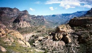
Just east of the city of Mesa, turning off at State Route 88 (Idaho Road) from State Route 60, is the historic Apache Trail. The 42-mile long trip offers a bumpy, back-door, Salt River route from Apache Junction, on the eastern outskirts of Phoenix, to Theodore Roosevelt Lake and then on to the mining town of Globe. The paved portion of the Apache Trail leads past a ghost town, a gold mine, a desert mystery and a cliff-sided lake.

Beyond the city lights and nearby residents of the East Valley, the Sonoran Desert  on display with yuccas and saguaros can be seen as you make the journey down a roller-coaster descent to a robber’s refuge, past a lazy lake, through a river canyon, and on to the extrinsically constructed dam, which paved the way to what Phoenix is today.

Patient drivers with no fear of heights are rewarded with three awe-inspiring desert lakes and the history and mystery of thousands of years of human adaptation to a volcanic landscape of drought, shard and thorn. The road, completed in 1905, initially used to aid in the construction of Roosevelt Dam, offers a jagged stretch of the Salt River, which first nourished a thousand years of Salado civilization, receives its waters from the White Mountains and the Mogollon Rim country.

The Lost Dutchman

The route continues to amaze with its rich history as you are lead past the touristy ghost town of Goldfield and then to the rugged Lost Dutchman State Park. Goldfield enjoyed a flurry as a gold-mining town in the 1890s when a rich gold strike supported a population of up to 5,000, and yielded about $1.5 million in bullion before the mine shafts flooded and the ore played out in 1897. The town revived a few years ago as a tourist attraction, with reconstructed buildings, exhibits and a simulated mine tour. The Mammoth Steakhouse and Saloon caters to meandering visitors, actors put on weekend gunfights, and mine tours offer a glimpse of the deadly life of a hardscrabble miner.

The Lakeviews

Apache Lake comes into view from a striking vista point. Protected by the harrowing drive and the minimal facilities, Apache Lake offers excellent fishing and some of the best lakeside camping opportunities in central Arizona. It has a marina, complete with boat rentals, a restaurant, fishing shop and motel rooms, but remains much less developed or visited than Canyon Lake. When full, Apache Lake stretches for 17 miles and measures 266 feet deep, although drought has lately lowered lake levels. Isolated stands of cottonwoods, accessible only by boat, provide good camping spots.

Roosevelt Dam. After a succession of floods and droughts repeatedly debilitated a string of farming communities along the Salt River in Maricopa County, a coalition of politicians, farmers and others convinced the federal government to build a massive dam on the river to control floods, store water and generate power
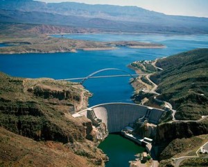
Photo Courtesy of US Bureau of Reclamation

Photo Courtesy of US Bureau of Reclamation

Roosevelt Dam

Faced with the floods and droughts, early Phoenix farmers pressed the federal government to build the dam that launched the reestablishment of the West. Roosevelt Dam created what was in 1911 the world’s largest artificial lake – Roosevelt Lake with a million-acre-foot capacity, a depth of up to 190 feet and 89 miles of shoreline. Wrestling the 344,000 cubic yards of masonry into place in the remote, flood-prone canyon proved unexpectedly dangerous. During construction, relying on an innovative 1,200-foot-long cable line with iron scoops that could hold 10 tons of rock and mortar, 42 men died.

Decades later, an analysis of the growth rings on ancient trees in cliff dwellings scattered throughout the Salt River watershed disclosed that the Salt River could generate much larger floods than the original dam engineers had anticipated. The discovery triggered in 1996 a $430 million upgrade of the dam, boosting its height 77 feet to 357 feet. The work included a $21 million, 1,080-foot-long bridge that stands as the longest, two-lane, single-span, steel-arch bridge in North America. The bridge, like a giant outstretched arm, reaches across the canyon of Roosevelt Lake, taking traffic off the top of the dam, which was barely wide enough to accommodate two Model T Fords abreast. Engineers significantly lowered the level of Roosevelt Lake during the project, and Arizona State University archaeologists conducted a series of archaeological digs around the lake. They found a huge complex of buildings that accommodated Salado farmers who irrigated with canals.

While it’s still unclear why the Salado Natives abandoned their homeland, this piece of mysterious history is tied into the rest of the amazing sights and antiquity – all on display along the Apache Trail.
Wigwam Resort

Photo Courtesy of Arizona Wigwam

Photo Courtesy of Arizona Wigwam

Does everyone remember Arizona’s 5 C’s? Copper, Cattle, Climate, Citrus and… cotton! Cotton is especially important to the town of Litchfield Park, home to the historic Wigwam Resort.

Originally, the Wigwam Resort was built to serve as a lodge for ranch suppliers. Goodyear Tire and Rubber Company discovered, in 1918, that cotton was the key ingredient to maintaining the life expectancy of its tires. The company bought 16,000 acres of land in the west Valley to cotton farm. To house workers, employees and ranching suppliers, the company established the Organization House, which also served as a winter vacation spot for Goodyear executives and their families.

The Wigwam officially opened on Thanksgiving Day in 1929, as a guest ranch with rooms for 24 guests. Five years later, a golf course was built. The resort has grown over the past 80 years and a portion of the original structure remains at the center of it all.

Visitors today can experience the 331-room resort, which includes three championship golf courses, tennis courts, swimming pools, a water slide, spa and luxury dining.

http://wigwamarizona.com/arizona-resort-history.shtml

El Tianguis Mercado

Photo Courtesy of Town of Guadalupe

Photo Courtesy of Town of Guadalupe

Nestled between Arizona’s capitol and the city of Tempe, at the base of South Mountain, lays the town of Guadalupe. A Native American and Hispanic community, the town boasts a strong cultural and ethnic identity, with a history dating back to 1907.

While in Guadalupe, stop and meander around El Tianguis Mercado. This courtyard-style shopping center is filled with unique shops and restaurants. Shoppers can purchase a variety of items from authentic Mexican pottery, Yaqui Indian art, leather boots, saddles, made-to-order piñatas and much more.

On weekends, the market is a vibrant place to visit, filled with visitors and live music.

http://www.guadalupeaz.org/index.asp?SEC=AA587FCD-BE4C-4AFB-9322-A1EB1021984F&DE=0C6E20B8-BDA2-4722-9AB3-B7D99E96640B&Type=B_BASIC

Estrella Mountain Regional Park

Photo Courtesy of Estrella Mountain Regional Park

Photo Courtesy of Estrella Mountain Regional Park

Estrella Mountain Regional Park, located in the city of Goodyear, offers more than 33 miles of trails for hiking, mountain biking, and horseback riding. Park Trails range in length from 2.3 miles to 8.8 miles and range in difficulty from easy to strenuous. If you are looking for an easy, relatively short hike, the 2.4 mile Baseline Trail is recommended. If you are looking for a long, all day hike, the Pederson Trail encompasses 8.7 miles.

Hiking and riding trails are easily accessible via trailheads located at the arena and amphitheater. A mountain bike trail brochure that categorizes trail difficulty is available at the park office. Visit Estrella’s Trails page for a complete list of trails and distances, and park hours.

Always remember to carry plenty of water and let someone know where you are going.