Blog Archive for August, 2014

Monument Hill and Base & Meridian Wildlife Center

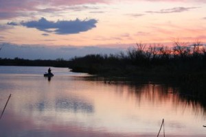
Photo Courtesy of the City of Avondale

Photo Courtesy of the City of Avondale

Right in the heart of Avondale lays a piece of Arizona’s geographic history. The initial survey point for the state of Arizona lies where the base line and principal meridian meet – right on a hill just east of Phoenix International Raceway.

The hill was constructed in 1851 by the US Boundary commission to draft a survey for the United States-Mexico Boundary under the 1848 Treaty of Guadalupe-Hidalgo. In 2002, it received status to be on the National Register of Historic Places.

Just below Monument Hill sits the Base & Meridian Wildlife Area. This area is approximately 198 areas and sits on the north bank of the Gila River. Visitors who come to this outdoor oasis gives a glimpse of Arizona wildlife, as the area is teeming with birds, mammals and fish, as well as a variety of vegetation like cottonwood, willow and mesquite trees.

Click here for more information

Peralta Trail – Superstition Wilderness

Photo Courtesy of ProTrails.com

Photo Courtesy of ProTrails.com

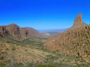
The Peralta Trail is located on the southwest edge of the Superstition wilderness, stretching through two diversely vegetated canyons highlighted by Weavers Needle – a 4,553-foot spire that towers over the landscape.

This hike is rather strenuous with varied terrain, and can easily do a loop of 6.2 mile’s worth of hiking. But the terrific views and useful insight to the canyons’ complex volcanic origin, which begins at the mouth of Peralta Canyon and climbs earnestly on a rugged, heavily vegetated path, make the hike an all-around pleasant experience. Oak and mesquite envelop portions of the trail along the canyon’s seasonally flowing creek, and once you’ve reached the Black Top Mesa, the view is breathtaking.

Plan a late-afternoon hike to watch the sunset, or early morning while it is still cool and sun begins to creep its way over the top of the majestic peaks. What you decide, you will not be disappointed in this serene desert hike.

Superstition Mountain Museum

Photo Courtesy of Superstition Mountain Museum

Photo Courtesy of Superstition Mountain Museum

Nestled in the east valley of the city of Apache Junction the Superstition Mountain Historical Society was formed on December 27, 1979.  As a non-profit corporation under Section 501 (c) 3, funding goes to organizing, collecting, and preserving the history and legends of Arizona’s Superstition Mountains, as well as the research, education and publications necessary to preserve history.

Perhaps nowhere in the entire United States is there an area full of legend, history and intrigue as the rugged 160,000 acre Superstition Mountain range in the Tonto National Forest in Central Arizona.

Archeological evidence indicates that people were here some 9000 years ago. Later inhabitants included the Salado, Hohokam and Apache Indians, followed by Spanish explorers and Mexican Gold Miners. Early American trappers and adventurers migrated to the area and were soon followed by cattlemen and farmers. Eventually, the U.S. Cavalry was sent in to establish forts to protect this rapidly growing population.

As modern times approached, men and women began searching for what they believed was the richest gold mine in the world. This mine was made famous by Jacob Waltz, known as “the Dutchman”, who took the secret of “his mine” to the grave in 1891.

Even today, treasure hunters scour the mountains searching for the Lost Dutchman Mine, but now they share the region with campers, hikers, horseback riders and conservationists in what has officially become the Superstition Wilderness Area.

http://superstitionmountainmuseum.org/

Tucson Recognizes Buffalo Soldiers with Memorial Project


Tucson recently proclaimed July 28 “Buffalo Solider Resolution Day.”

The proclamation was conducted by the Honorable Jonathan Rothschild and the Honorable Richard Fimbres.

This is part of Tucson’s Buffalo Soldiers Memorial Project, which is a collaboration between City of Tucson, Ward 5, Arizona Historical Society, The Greater southern Arizona Area Chapter, 9th and 10th Cavalry Association, 9th Memorial Cavalry, Inc., 10th Memorial Cavalry, Inc., Omega Psi Phi Fraternity and Arizona Heritage Tours.

If you don’t reside in Tucson, still feel free to celebrate the Buffalo Soldiers by reading about their history below (retrieved from the Buffalo Soldier Proclamation Program):

In 1866 Congress authorized, for the first time, African Americans to serve in the peacetime army of the United States. Two cavalry and four infantry regiments were created and designated the 9th and 10th U.S. Cavalry regiments and the 38th, 39th, 40th, and 41st U.S. Infantry regiments.  The four infantry regiments later became the 24th and 25th Infantry regiments. The all-African American regiments, commanded mostly by white officers, were composed of Civil War veterans, former slaves, and freemen.

Throughout the period of the Indian Wars, about 20% of the U.S. Cavalry troopers and 8% of the infantry soldiers were African American. The Buffalo Soldiers rose above the challenges of harsh living conditions, difficult duty, and racial prejudice to gain a reputation of dedication and bravery. Thirteen Medals of Honor were awarded to Buffalo Soldiers during the Indian Wars, and five were awarded during the Spanish-American War. Stationed on the U.S. frontier from the 1860s to the 1890s, Buffalo Soldiers played a major role in the settlement and development of the American West.  Following the first Buffalo Soldiers, African American regiments later served in the Spanish-American War, Philippine Insurrection, Mexican Punitive Expedition, World War I, World War II, and the Korean War. In the 1950s, African American regiments were disbanded when all military services were integrated. At that time, for the first time, black and white soldiers served together in the same regiments.

Buffalo Soldiers were known to have played a significant historical role in at least six parks in the American Southwest:  Fort Davis National Historic Site (FODA) and Guadalupe Mountains National Park (GUMO) in Texas; Fort Larned N.H.S. (FOLS) in Kansas; and Fort Bowie N.H.S. (FOBO) and Chiricahua National Monument (CHIR) in Arizona. Buffalo Soldiers were also stationed at Fort Huachuca (still an active military installation) near Coronado National Memorial (CORO) in Arizona. Throughout these sites, the soldiers protected traffic on the San Antonio-El Paso Road, helped build Fort Davis into one of the largest posts in Texas, participated in campaigns against Native Americans, protected settlers and guarded stage stations, constructed roads and telegraph lines, and explored and mapped previously unmapped regions.  Colonel Charles Young was the first African-American to head the National Park System.


The Cove


The Sierra Vista Aquatic Center, aka “The Cove,” is a 36,500 sq ft facility that contains 11,347 sq ft of pool water surface, which equates to over 575,000 gallons of water. The Aquatic Center boasts a 0′ depth, or “beach”,’ entry and eight 25 yard lap lanes for lap and competitive swimming, and a wave machine with several wave patterns for Open Swim. Smaller children can enjoy a water play area of less than 2-feet of water where they can pretend to be pirates on the pirate ship slide.For those looking for a more relaxing time, there is also a warm water therapy pool that is always 92 to 94 degrees and complete with water jets. The diving pool includes two 1 meter diving boards and one 3 meter diving board. And just for fun, there are two enclosed tube slides that will take you on a ride inside AND outside the building! The Cove also has locker rooms for men, women, and families with small children. Lockers are available free of charge for the day, however, customers are strongly encouraged to bring a lock in order to secure their valuables. Locks are also available for purchase at the front desk. A snack bar and outdoor patio are available as well to hang out and take a break from all the fun. For more information, please visit: http://www.sierravistaaz.gov/

Sky Island Scenic Byway

sky island scenic byway_southern_7.28.14

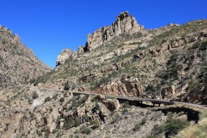
Climbing more than 6,000 feet,the Sky Island Scenic Byway begins with forests of saguaro cacti in the Sonoran Desert and ends in a cool, coniferous forest on the Santa Catalina Mountains. Prepare yourself for breathtaking views and a climate change that would be similar to driving from Southern Arizona to Northern Montana. Each thousand feet up is like driving 600 miles north offering a unique opportunity to experience 4 seasons in one trip.

The scenic drive begins at the outside edge of Tucson. If you are coming from I-10, take exit 256 and follow East Grant Road for 8 miles. Turn left onto East Tanque Verde Road and continue for three miles until East Catalina Highway on your left. The start of this scenic drive is in 4 miles as you enter the Coronado National Forest. This road is sometimes referred to as Mount Lemmon Highway or Hitchcock Highway.

If you are traveling this route in the winter, keep in mind that temperature differences from bottom to top is around 30 degrees and that upper portions may be closed due to snow. And in any season — bring water, extra clothes and gas up beforehand as there are no stations along the Catalina Highway.

As the road climbs among the Saguaro cacti and brittlebush, enjoy hairpin curves as you arrive at the Babad Do’ag Viewpoint (V1) which overlooks the desert cacti studded Tucson Valley, the Rincon Mountains, and the Tucson Basin. There are interpretive signs at the lookout and if you’re up for a longer hike — try the moderate 5-mile round trip Babad Do’ag Trail. Incredible desert vistas of saguaro, wildflowers and mountains await.

Continuing up the road, you enter the Molino Canyon. The road hugs the canyon’s cliff until the Molino Canyon Overlook (V2). The overlook offers a short hike to a creek and series of waterfalls. Towards the center of the canyon is the Molino Basin, home a campground and trailheads for a variety of hikes. Hiking here is especially fascinating due to the transition from desert to a forest dominated by cottonwood, oak, sycamore and willow trees within a very short distance.

Each turn of the road reveals a new perspective. As you enter Bear Canyon, the forest transforms once again into a lusher, cool environment with flourishing cypress, juniper, pine, sycamore, and walnut trees. Granite pinnacles soar into the sky, and with rocky outcroppings and stony hoodoos, some of Arizona’s best rock climbing is found here.

Next stop, Windy Point (V3) offers the most amazing views along the entire drive. Wind-whipped rock formations, views of the Huachuca, Patagonia, and Santa Rita Mountains, and the Tucson Basin await at 6,400 feet of elevation. On clear days, you may even see the Sierra de San Antonio in Mexico.

Geology Point Vista (V4), offers another spectacular viewpoint. Sweeping panoramas and precariously perched rocks create a surreal and photogenic landscape.

From here, you climb through forests of ponderosa pine. Rose Canyon Lake (W1) is stocked with trout and surrounded by absolute beauty; this seven-acre lake is a perfect stop for fishing, picnics, and camping in the Rose Canyon Campground. Keep an eye out for the turn off to Rose Canyon. Shortly afterwards, you arrive at the San Pedro Vista (V5) which overlooks the San Pedro River Valley, a desert between the Tortilla and Galiuro Mountains. From this stop, enjoy the 4-mile hike around Green Mountain to the General Hitchcock Campground.

Shortly after the viewpoint is the Palisade Information Center (I1). Self-guided displays inform about the Coronado National Forest and it’s a great location to get more information about hikes. Two of the most popular are the Butterfly Trail (H2) and Crystal Springs Trail (H3) with trailheads one mile from the center. Both trails are long, but you need not do the entire trail to enjoy the shaded, dense forests. Butterfly Trail (H2) features such a diverse biology, it has been designated a Research Natural Area. Wildflowers and butterflies are abundant and having a species field guide will come in handy. If you are up for a challenge, the medium-to-difficult Crystal Springs Trail will bring you to Mount Lemmon’s summit.

Experience the sky up close at the Mount Lemmon SkyCenter (A1). There are daytime and after-dark programs using their new 32-inch Schulman Telescope which is open to the public.

This scenic drive officially comes to an end as you arrive in the quaint town of Summerhaven, which features a General Store, shops and restaurants. While here, consider a few short side trips. For spectacular views in every season, Mount Lemmon Ski Valley, the southernmost ski area in the US, can be reached via East Ski Run Road. The ski hill offers an opportunity to ride the ski lift for breathtaking vistas at 9100 feet. Continue a few miles further and join onto Summit Road (T1). At the road end is the actual summit of Mount Lemmon, an amazing way to end this scenic drive.