Joshua Forest Scenic Drive
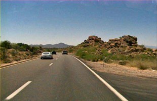
Photo Courtesy Arizona Department of Transportation
Saguaros stand next to Joshua trees, cliffs and canyons loom to the east and west and granite boulders give way to an expanse of jagged volcanic rock. Between Wickenburg and Wikieup, this 54-mile byway cuts a path through the blurred boundaries the Sonoran and Mojave deserts.
The drive officially begins in Wikieup. Wikieup is known for its pie, the Snoopy-piloted Wikieup arrow, the Wikieup Trading Post, Eat at Joe’s Barbecue and the creosote-peppered hills that surround Bronco Wash.
Once travelers move past Wikieup, they’ll find the Big Sandy River. The river, unless it’s been rainy, lives up to its name—it’s big and sandy. Beyond the river, eroded cliffs loom that are speckled in spots with saguaros and scrub.
At Mile Marker 147, travelers will see rocks that are piled on top of each other. It’s the perfect sight before arriving at the town of Nothing. Nothing was a real Arizona town, but it remains fairly desolate now. When travelers spot it, they’ll see there isn’t much beyond junk.
Joshua trees become the focal point of this drive around Mile Marker 162. They’re reminiscent of the baobab trees made famous in Saint Exupery’s Little Prince, and if your imagination is active, you might see a little blonde boy emerge from the trees with a dog and a well-protected flower in hand.
By Mile Marker 169, the forest of Joshua trees is dense and you’ll see a sign that reads: “Joshua tree Parkway of Arizona.” The route continues on to Wickenburg, a classic Old West town that celebrates the state’s cowboy heritage with the Desert Caballeros Museum and a string of Western-themed shops and restaurants.