Blog Posts Tagged ‘central-arizona’

World’s Tallest Kachina

Photo Courtesy of AZ Central

Photo Courtesy of AZ Central

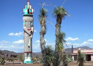
Located in Cave Creek is the World’s Tallest Kachina sits proudly in the open desert. Just north of Phoenix on Cave Creek Road, and on through Carefree, continue east for about five miles on Cave Creek Road, located at the entrance to the Tonto Creek subdivision sits the 39-foot statue.

Kachina Dolls (or Katsina) are a unique Hopi invention. Kachinas are made by Hopi craftsmen who’ve honed their skills over several years. The masked religious icons are carved from cottonwood root, and they were used to teach children of the tribe about the spirit world.

Casa Grande Ruins

Photo Courtesy of Arizona Preservation Foundation

Photo Courtesy of Arizona Preservation Foundation

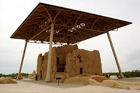
When we can’t understand our past in its entirety, a sense of wonder takes the place of facts. Casa Grande Ruins is one such place that offers such feelings of mystery. While the ruins may have appeared around 130 C.E., its purpose remains a mystery.

Every year, we learn a little more, though. Archeologists have discovered evidence that the ancient Sonoran Desert people who built the Casa Grande also developed wide-scale irrigation farming and extensive trade connections which lasted over a thousand years until about 1450 C.E. It is believed that the Casa Grande functioned partly as an astronomical observatory since the four walls face the points of the compass. There are various smaller ruins in the complex and remains of a Hohokam farming village.

Visitors of the ruins will see the curious appearance of the structure. Visitors are not allowed into the building, due to it being very delicate, but much can be seen from the outside. Visitors will be able to see details of the construction with wooden beams supporting the clay walls and various internal features such as stairways and windows. The interior contains items such as re-enforcing beams, metal ladders and measuring devices on the walls.

Veterans Oasis Park

Photo Courtesy of the Arizona Republic

Photo Courtesy of the Arizona Republic

The city of Chandler is a growing community, home to a large population, a bustling downtown and the state’s biggest technology businesses.

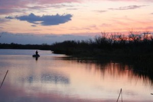
Peeking through the busy-ness of the city is an 113-acre oasis that boasts lush wetland and desert wildlife. The Veterans Oasis Park is known as the city’s “non-traditional” facility, which features habitat suitable for diverse plants and wildlife and offers plentiful recreation opportunities at the site. The park includes park land, lake, wetlands and recharge basins, which infiltrate high-quality reclaimed water to the subsurface as part of the city’s comprehensive reclaimed water management plan.

Visitors to the park can experience recreational opportunities galore. There are more than four miles of trails and wildlife viewing areas. Families can also enjoy a daytime picnic in the ramadas and picnic areas and introduce children to wildlife in the butterfly and hummingbird habitat. Children can also roam around and enjoy the outdoor ampitheatre and a unique learning-oriented playground. There is also a 5-acre community fishing lake, equestrian trails and a Solar System Walk.

Take a day trek away from the hustle and bustle of the burgeoning east valley communities and enjoy all the amenities this park has to offer.

http://www.chandleraz.gov/default.aspx?pageid=682

America’s Largest Sundial

Photo Courtesy of City of Carefree  Photo taken by Thomas Baker, 2013

Photo Courtesy of City of Carefree
Photo taken by Thomas Baker, 2013

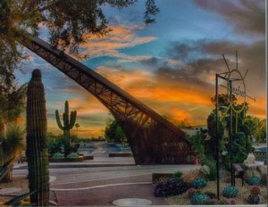
The famous carefree sundial was designed in 1959 by Architect Joe Wong and solar engineer John I Yellott.  To create a huge sundial at a time when sundials were outdated was a very bold move of Wong and Yellott. To many, this move serves as a reminder of how important time and our created perception of  it has always been and always will be.

The sundial, which points to the North Star, is made from a steel frame and covered in anodized copper. It measures 90 feet in diameter. The metal gnomon, the shadow-casting portion of the dial, stands 35 feet above the plaza and extends about 72 feet.

The sundial also acts as the starting point for the self-guided walking tour of the Carefree Desert Gardens (CDG), if you’re up for an added adventure.

The sun’s shadow has made its way around the Carefree sundial many times since its initial creation in 1959, and will continue to do so for many years to come. Venture out this summer to the sundial so you can be a part of one of the sun’s daily rotations.

Verrado Golf Club

Photo Courtesy of Verrado Golf Club

Photo Courtesy of Verrado Golf Club

It’s no secret that Arizona is home to some of the most beautiful golf courses in the world. In the West Valley town of Buckeye lies the Verrado Golf Club, 18 holes surrounded in the foothills of the picturesque White Tank Mountains.

Golfers spending time on the championship golf course will view large mountains, desert washes, box canyons and the Phoenix skyline off in the distance. The course is perfect for both amateurs and aficionados, playing to nearly 7,300 yards and offering generous landing areas.

While the summer sun can sometimes put a damper on outdoor activities, golfing in the summer is one advantage to living in AZ. Verrado has summer specials with prices that are just as sizzling as that sunshine.

http://www.verradogolfclub.com/

Monument Hill and Base & Meridian Wildlife Center

Photo Courtesy of the City of Avondale

Photo Courtesy of the City of Avondale

Right in the heart of Avondale lays a piece of Arizona’s geographic history. The initial survey point for the state of Arizona lies where the base line and principal meridian meet – right on a hill just east of Phoenix International Raceway.

The hill was constructed in 1851 by the US Boundary commission to draft a survey for the United States-Mexico Boundary under the 1848 Treaty of Guadalupe-Hidalgo. In 2002, it received status to be on the National Register of Historic Places.

Just below Monument Hill sits the Base & Meridian Wildlife Area. This area is approximately 198 areas and sits on the north bank of the Gila River. Visitors who come to this outdoor oasis gives a glimpse of Arizona wildlife, as the area is teeming with birds, mammals and fish, as well as a variety of vegetation like cottonwood, willow and mesquite trees.

Click here for more information

Peralta Trail – Superstition Wilderness

Photo Courtesy of ProTrails.com

Photo Courtesy of ProTrails.com

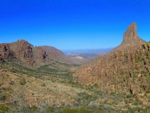
The Peralta Trail is located on the southwest edge of the Superstition wilderness, stretching through two diversely vegetated canyons highlighted by Weavers Needle – a 4,553-foot spire that towers over the landscape.

This hike is rather strenuous with varied terrain, and can easily do a loop of 6.2 mile’s worth of hiking. But the terrific views and useful insight to the canyons’ complex volcanic origin, which begins at the mouth of Peralta Canyon and climbs earnestly on a rugged, heavily vegetated path, make the hike an all-around pleasant experience. Oak and mesquite envelop portions of the trail along the canyon’s seasonally flowing creek, and once you’ve reached the Black Top Mesa, the view is breathtaking.

Plan a late-afternoon hike to watch the sunset, or early morning while it is still cool and sun begins to creep its way over the top of the majestic peaks. What you decide, you will not be disappointed in this serene desert hike.

Superstition Mountain Museum

Photo Courtesy of Superstition Mountain Museum

Photo Courtesy of Superstition Mountain Museum

Nestled in the east valley of the city of Apache Junction the Superstition Mountain Historical Society was formed on December 27, 1979.  As a non-profit corporation under Section 501 (c) 3, funding goes to organizing, collecting, and preserving the history and legends of Arizona’s Superstition Mountains, as well as the research, education and publications necessary to preserve history.

Perhaps nowhere in the entire United States is there an area full of legend, history and intrigue as the rugged 160,000 acre Superstition Mountain range in the Tonto National Forest in Central Arizona.

Archeological evidence indicates that people were here some 9000 years ago. Later inhabitants included the Salado, Hohokam and Apache Indians, followed by Spanish explorers and Mexican Gold Miners. Early American trappers and adventurers migrated to the area and were soon followed by cattlemen and farmers. Eventually, the U.S. Cavalry was sent in to establish forts to protect this rapidly growing population.

As modern times approached, men and women began searching for what they believed was the richest gold mine in the world. This mine was made famous by Jacob Waltz, known as “the Dutchman”, who took the secret of “his mine” to the grave in 1891.

Even today, treasure hunters scour the mountains searching for the Lost Dutchman Mine, but now they share the region with campers, hikers, horseback riders and conservationists in what has officially become the Superstition Wilderness Area.

http://superstitionmountainmuseum.org/