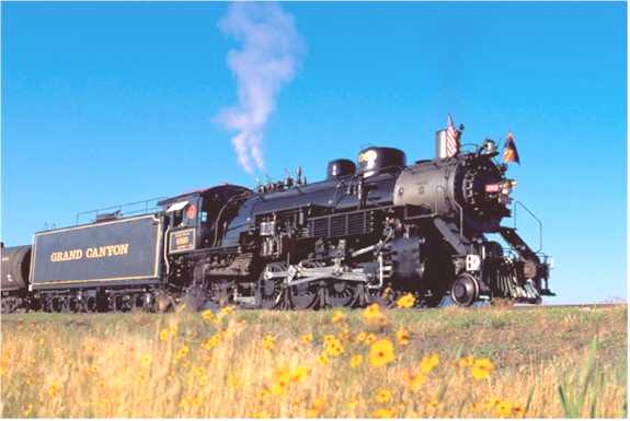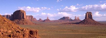
Courtesy Photo VisitArizona.com
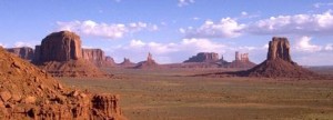
The breathtaking view of rocky formations jutting out of the desert floor, also known as Monument Valley, sits on the Navajo Indian Reservation in northern Arizona, attracting thousands of visitors every year. The scenery invites all to wander among the sandstone pinnacles with such names as The Mittens, Three Sisters, Totem Pole and Yeibichai. This is the land moviemaker John Ford made famous decades ago – the same land that helped make actor John Wayne a star. Travelers can see this homeland of the Navajos by journeying up US Route 163, the Kayenta-Monument Valley Scenic Road near the Arizona-Utah border, near the city of Page.
Beginning in 1939, the Westerns that Ford filmed featured the glory of red mesas , and while sparsely settled by Navajo sheepherders and a few others, became a mecca for sightseers and Old West buffs. Few places offer such a distinct link to the past. People first arrived in the region nearly 12,000 years ago when, archaeologists believe, nomadic tribes followed large game, like woolly mammoths, into the area. Over time, the game became smaller, the people more sophisticated.
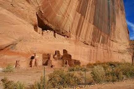
Around A.D. 700, significant advances in weaponry and agriculture allowed people to settle permanently. The Anasazi, or ancestral Puebloans, with their superior hunting and farming techniques, developed the first stationary community in the region. Around A.D. 1250, the Puebloans moved from the area leaving their dwellings, now ruins throughout the Navajo Nation. Navajos entered the region later, sometime around A.D. 1500, though there are conflicting theories. Fighting over the land continued almost constantly – whether between different tribes, Spaniards, Mexicans or European-Americans – the region remained awash with turmoil for several centuries. It wasn’t until after the forced “Long Walk of the Navajos” into captivity in New Mexico in the 1860s that the Navajos returned home and witnessed the recognition of their land as sovereign.
The beauty of Monument Valley did not remain secret for very long. An archaeological expedition, funded by the American Museum of Natural History and headed by Charles L. Bernheimer, moved into the valley in 1927. With the help of John Wetherill, Bernheimer sought out sites such as Rainbow Bridge, an enormous natural, rocky arch that stretches 275 feet across at a height of 270 feet. Old Mike, a Ute Indian, then led the group to another natural bridge formation on June 8, 1927. Dubbed Clara Bernheimer Natural Bridge, after Bernheimer’s wife, the obscurely located arch hidden in the remote northern pocket of Arizona appeals to those with a taste for the extreme.